

Credit: Pixxel
Pixxel, an Indian space data start-up, has unveiled the first set of images from its hyperspectral pathfinder satellites as part of its ‘First Light’ Campaign.
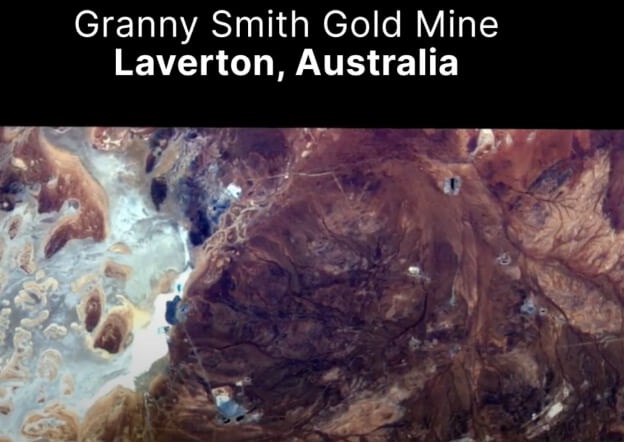
Providing data for the detection, identification and quantification of surface materials as well as biological and chemical processes, the images highlight specific factors such as soil types, mountain ranges, bare lands, gold mines, reservoirs, agricultural farms, delta regions and urban settlements.
“The images will help unearth unseen problems that are invisible to satellites in orbit today and enable sectors to make more informed and evidence-backed decisions related to global phenomena,” said Awais Ahmed, CEO of Pixxel.
“With the launch of the recent 10m Shakuntala satellite, Pixxel now has the highest resolution hyperspectral capacity that we’re beaming down and sharing with our customers.”
The company has experienced a year of growth, signing partnerships with several organisations across the globe, including Australian agritech firm DataFarming, Australian-British mining company MNC – Rio Tinto, Columbia’s Procalculo and geospatial specialist company, Geoimage.


