

One of the great challenges to increasing the sustainability of land management is the need to integrate many different kinds of data at many different scales. In a step towards addressing this problem, cyber-infrastructure professionals from a number of the Australian Government’s National Collaborative Research Infrastructure Strategy (NCRIS) program capabilities, including TERN, have joined forces […]
Cardno Acquires Australian Underground Services
By Spatial Source on 1 January, 1970International infrastructure services group Cardno has acquired Australian Underground Services. AUS provides utility detection and mapping services using surface geophysical technologies. Its work also includes non-destructive vacuum excavation and data management services. It has around 30 staff based in Victoria. AUS is expected to contribute revenue of around $5 million to Cardno annually. […]
Latest Geospatial News
View allCool Tools
View All-
 CHC Navigation at Locate26: Connected Geospatial Solutions Across Land, Air and Water
-
 Responsible AI for better decisions: Why geospatial context matters
-
 Stop parking it: meeting the Essential Eight with ArcGIS may be more achievable than you think
-
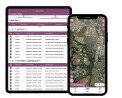 GBM Konect launches Konect 2 to close the field data gap
Events
View All-
Nov 6
GIS in Local Government Day 2026
 Amora Hotel Adelaide, 233 Victoria Square, Adelaide
-
Nov 9
2026 Advancing Earth Observation Forum
Hobart, Tasmania -
Nov 10
SouthPAN Industry Day
Online -
Nov 13
South West and Great Southern Surveyors Conference
Mantra Bunbury Lighthouse, Bunbury, WA -
Nov 24
Locate26 Conference / 10th Digital Earth Summit
Melbourne Convention & Exhibition Centre

