

The Geospatial Information & Technology Association (GITA) is a worldwide not-for-profit organisation that provides excellence in education and information exchange on the use and benefits of geospatial information and location-aware technologies for asset and infrastructure management. GITA holds regional seminars and workshops throughout Australia and New Zealand.
IGS Workshop and Vertical Rates Symposium
By Spatial Source on 24 May, 2010This workshop will focus on the application and status of current international GNSS service (IGS) operations and possibilities for future improvements. WHEN: 2010-06-28 to 2010-07-02WHERE: Newcastle, EnglandSTATE: InternationalCOUNTRY: INT International GNSS Service (IGS) http://www.ceg.ncl.ac.uk/igs2010/
China and Brazil Share Data
By Spatial Source on 13 May, 2010China and Brazil have signed an agreement that gives both countries direct access to data from the China-Brazil Earth Resources Satellite Program. CBERS is a jointly operated remote sensing system for agriculture, meteorology and the environment. The document was signed by the Xu Wen, president of the China Centre for Resources Satellite Data and Application, […]
Find UK Launches Online Service
By Spatial Source on 13 May, 2010The UK online mapping website Find has launched a service that enables users to order Land Registry documents via a map interface. The system is designed for commercial organisations. It uses maps instead of exact addresses to determine land ownership, according to the company. Users select a map location, zoom into the area of […]
NZ Publishes Land Use Map
By Spatial Source on 13 May, 2010New land use data for New Zealand is now available to the public, following the completion of a major mapping exercise by the NZ environment ministry. The integrated Land Use Map provides a detailed overview of land use in New Zealand from 1990–2008. The map has been produced as part of the Land Use […]
IBM Creates World’s Smallest 3D Map
By Spatial Source on 13 May, 2010IBM scientists have created the smallest 3D map of the Earth. How small is it? So small that 1,000 such maps could fit on a grain of salt. The scientists used a new technique involving a tiny silicon tip with a sharp apex – one million times smaller than an ant – to create […]
Remote Sensing Market Continues to Grow
By Spatial Source on 13 May, 2010The global civil and commercial remote sensing satellite market will be worth $16 billion by 2019, according to projections by US market intelligence firm Forecast International. And over the coming decade, it says, more than 100 individual remote sensing satellites will be launched. The projections are contained in a report titled The Market for […]
Crime Mapping in Australia
By Spatial Source on 13 May, 2010The Australian Crime Commission is looking for GIS and vector mapping software to create a national map of crime. A project tender released by the commission involves the creation of maps through a GIS, with a panel of external providers suppling the mapping software. The panel will also provide geospatial imaging and support for […]
Chinese Spatial Industry Booming
By Spatial Source on 13 May, 2010The value of China’s spatial information industry is expected to reach CNY 100 billion (about 158 million AU) this year, according to China Association for Geographic Information Systems. "The geographic information industry has entered a stage of fast development in recent years," said Cong Yuandong, secretary general of the association. But finding professionals with […]
Alligator Bayou Wins Bizarre Map Challenge
By Spatial Source on 13 May, 2010An alligator bayou has claimed the top prize in an unusual mapping contest. The Bizarre Map Challenge was devised by California’s GeoTech Centre and San Diego State University to generate interest in geospatial thinking. The competition was open to US high school, college and university students. The challenge was to create a map that […]
Latest Geospatial News
View allCool Tools
View All-
 Responsible AI for better decisions: Why geospatial context matters
-
 Stop parking it: meeting the Essential Eight with ArcGIS may be more achievable than you think
-
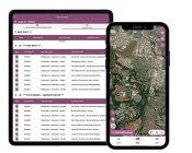 GBM Konect launches Konect 2 to close the field data gap
-
 Inside the 12d Tech Forum 2026: Automation, Collaboration, and the Industry’s Next Chapter
Events
View All-
Oct 30
Tasmanian Surveying & Geospatial Conference 2026
 Country Club, 100 Country Club Avenue, Prospect Vale (Launceston)
-
Oct 30
Western Australia EISSI Awards 2026
Pan Pacific, Perth -
Nov 9
2026 Advancing Earth Observation Forum
Hobart, Tasmania -
Nov 10
SouthPAN Industry Day
Online -
Nov 13
South West and Great Southern Surveyors Conference
Mantra Bunbury Lighthouse, Bunbury, WA

