

NASA's Lunar Reconnaissance Orbiter has been sending detailed images of the moon from its 50km orbit to scientists since June 2009. The images provide remarkably detailed views of the lunar surface, including features as small as 50cm. Over the course of its mission, LRO is expected to generate 70-100 terabytes of data – […]
GPS Data Confirms Greenland Rising
By Spatial Source on 27 May, 2010Greenland's ice is melting so quickly that the giant island is rising by nearly an inch per year in some coastal areas, according to US researchers. The rise seems to be increasing as the huge ice cap pushing down much of Greenland disintegrates. The scientists from the University of Miami used specialised GPS receivers stationed […]
Trimble User Conference
By Spatial Source on 27 May, 2010Trimble is calling for speakers for its 2010 user conference, Trimble Dimensions, which will be held 8-10 November in Las Vegas. Themed Converge, Connect, Collaborate, the event will explore how the convergence of technology can redefine the way surveying, engineering, construction, mapping, GIS, geospatial, infrastructure, utilities, and mobile resource management professionals work together. Organisers are […]
Beidou Global by 2020
By Spatial Source on 27 May, 2010The Chinese navigation satellite system Beidou, also known as the Compass Navigation Satellite System, is expected to provide global service by 2020, according to the system's chief designer Sun Jiadong. Compass will provide a free service for civilian users with positioning accuracy of within 10 metres, velocity accuracy of within 0.2 m/s and timing accuracy […]
Victoria to Open Visualisation Centre
By Spatial Source on 25 May, 2010An Australian team is working to establish an advanced image processing facility that will allow scientists to work with high-resolution images and 3D models previously too large to visualise. Monash University is partnering with technology providers and other research institutions on the project. The Multi-modal Australian Sciences Imaging and Visualisation Environment will be known […]
Climate Change and Farming in Vietnam
By Spatial Source on 25 May, 2010The federal government has committed $4.1 million to examine the impact of climate change on rice farming in Vietnam. The project, led by the Australian Centre for International Agricultural Research, will involve a geospatial biophysical impact and vulnerability assessment. It also includes plant breeding for improved resilience to salinity and submergence, development of integrated […]
Simmersion Wins Government Grant
By Spatial Source on 25 May, 2010Simmersion Holdings has secured Australian government funding for the commercialisation of its Mycosm 3D visualisation platform. The funding was granted through the Commercialisation Australia program. It will be used to help launch Mycosm into the e-learning, sales and marketing, decision support and entertainment markets. The platform creates real time high fidelity 3D visualisations.The […]
Leica Viva Uno
By Spatial Source on 25 May, 2010Leica’s Viva Uno is a handheld GNSS solution for centimetre surveying. It comes with the company’s SmartWorx Viva software and Leica Geosystems GNSS technology. The product is designed for large scale data collection for a variety of industries including utilities, agriculture, and road infrastructure. The onboard Viva software provides non-technological terminology, setup wizards and […]
NovAtel IMU-LCI
By Spatial Source on 25 May, 2010NovAtel’s latest release in its GNSS/INS SPAN family contains a Northrop Grumman sensor. The IMU-LCI provides the low noise and stability required for precise positioning and attitude, says the manufacturer. The IMU-LCI is a tactical-grade IMU with fibre-optic gyros and micro-mechanical accelerometers. According to NovAtel, both gyros and accelerometers operate with minimum noise and […]
Leica ScanStation C10 Updated
By Spatial Source on 25 May, 2010Leica has announced a number of updates for its ScanStation C10 laser scanner. These are based on new versions of scanner firmware (v1.2) and Cyclone software (v7.0.3). New features include wireless LAN connectivity for remote scanner operation, and new imaging options for the embedded, parallax-free digital/video camera.The updates include expanded data management options for […]
Latest Geospatial News
View allCool Tools
View All-
 Responsible AI for better decisions: Why geospatial context matters
-
 Stop parking it: meeting the Essential Eight with ArcGIS may be more achievable than you think
-
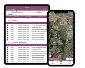 GBM Konect launches Konect 2 to close the field data gap
-
 Inside the 12d Tech Forum 2026: Automation, Collaboration, and the Industry’s Next Chapter
Events
View All-
Oct 30
Tasmanian Surveying & Geospatial Conference 2026
 Country Club, 100 Country Club Avenue, Prospect Vale (Launceston)
-
Oct 30
Western Australia EISSI Awards 2026
Pan Pacific, Perth -
Nov 6
GIS in Local Government Day 2026
Amora Hotel Adelaide, 233 Victoria Square, Adelaide -
Nov 9
2026 Advancing Earth Observation Forum
Hobart, Tasmania -
Nov 10
SouthPAN Industry Day
Online

