

GIS lounge has a post on the first global map of the world’s forest heights. The Google Geo Developers blog reports on new features in Google Earth, including a better way to represent movement on and above the globe. Googlemapsmania talks about Project Feeder Watch, which allows users to display bird populations visually on […]
Lidar Mapping Forum 2011
By Spatial Source on 22 July, 2010The event will showcase more than 50 leading companies in this rapidly growing global market. WHEN: 2011-02-07 to 2011-02-09WHERE: New OrleansSTATE: InternationalCOUNTRY: INT The eleventh in a series that has long established itself as the premier LIDAR event, attracts professionals from around the world with one focused objective of sharing information on LIDAR technology and […]
International Conference on Spatial Data Infrastructures
By Spatial Source on 20 July, 2010The main theme of the Conference will be the development and use of Spatial Data Infrastructures (SDI’s) and all their aspects – technology, criteria and standards for organizing and sharing spatial data. WHEN: 2010-09-15 to 2010-09-17WHERE: Skopje, MacedoniaSTATE: InternationalCOUNTRY: INT The realization of the European INSPIRE directive in the countries of South East Europe is […]
International Society of Photogrammetry and Remote Sensing Congress
By Spatial Source on 20 July, 2010Eight exciting days of tutorials, workshops, presentations and technical tours. WHEN: 2012-08-25 to 2012-09-01WHERE: MelbourneSTATE: VICCOUNTRY: AUS The theme for the Congress is Imaging a Sustainable Future. Images, whether of the visible or non-visible spectrum, whether aerial or satellite, or whether of agriculture or cultural heritage, are a fundamental resource for sustaining the future of humankind. […]
Geospatial World Forum
By Spatial Source on 20 July, 2010The biannual global confluence of geospatial professionals. WHEN: 2011-01-18 to 2011-01-21WHERE: Hyderabad, IndiaSTATE: InternationalCOUNTRY: INT Geospatial World Forum shall be driven by an objective to provide an appropriate representation of geospatial industry and its relevance in tomorrow's world. More information can be found at www.geospatialworldforum.org.
Best of the Blogs
By Spatial Source on 20 July, 2010On the blogs today MIbazaar points out a site that has developed new way of browsing international news geographically that highlights those cities where “news” is increasing. Moving your mouse over the globe reveals each city’s top news story. Googlemaps mania reports that Google has updated some of the satellite imagery on Google Maps and […]
Reducing Congestion via Satellite
By Spatial Source on 19 July, 2010Singapore transport will explore the use of satellite tracking technology to update its electronic road pricing system and reduce road congestion, the government has announced. The system involves using a GNSS to monitor all the location of vehicles via transmitters. Traffic congestion is a big problem in Singapore. A road pricing technology, involving placing short-range […]
Mapping Flooding from Climate Change
By Spatial Source on 19 July, 2010The Department of Climate Change will distribute a new mapping tool to help councils identify which areas may be flooded by rising sea levels. The pilot Coastal Inundation Visualisation tool has been developed over the past two years in response to demands for higher resolution information on the risks of sea level rise. The application […]
$200 million for Smart Grid Ideas
By Spatial Source on 19 July, 2010GE has announced a US $200 million innovation contest that seeks ideas from the public to create a smarter, cleaner, more efficient electricity grid. The challenge invites technologists, entrepreneurs and start-ups to share their best ideas on how to build grids that distribute energy with less waste and allow more renewables to be connected. […]
Electoral Mashup
By Spatial Source on 19 July, 2010With the looming threat of a federal election in Australia, a new application that provides detailed demographics for each electorate could become an integral tool in the campaigning frenzy. Although the tool has been designed for those working in electoral campaign offices, the app also offers interesting information for the casual user or anyone interested […]
Latest Geospatial News
View allCool Tools
View All-
 CHC Navigation at Locate26: Connected Geospatial Solutions Across Land, Air and Water
-
 Responsible AI for better decisions: Why geospatial context matters
-
 Stop parking it: meeting the Essential Eight with ArcGIS may be more achievable than you think
-
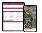 GBM Konect launches Konect 2 to close the field data gap
Events
View All-
Nov 6
GIS in Local Government Day 2026
 Amora Hotel Adelaide, 233 Victoria Square, Adelaide
-
Nov 9
2026 Advancing Earth Observation Forum
Hobart, Tasmania -
Nov 10
SouthPAN Industry Day
Online -
Nov 13
South West and Great Southern Surveyors Conference
Mantra Bunbury Lighthouse, Bunbury, WA -
Nov 24
Locate26 Conference / 10th Digital Earth Summit
Melbourne Convention & Exhibition Centre

