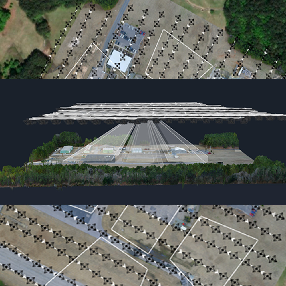
Until recently, photogrammetric mapping was performed with expensive aerial mapping cameras pointed directly towards the ground in what is known as nadir. However, when photogrammetric processing tools and aerial imagery moved into the digital environment, the need to constrain imagery to nadir became less of an issue when trying to create quality mapping deliverables. Add to this that the range of deliverables themselves has evolved to include 3D models.
It is true that oblique images may capture vertical structures, potentially enabling better texturization of features such as the sides of buildings. But are they useful for mapping? Is not one camera offset from nadir and the flight planned correctly sufficient to provide the same benefit as a multi-camera set up? Is nadir imagery not sufficient for mapping? Is there really a value in 3D models as a mapping deliverable?
Watch the workshop recording of ‘Obliques for Mapping: Are They Really Useful’ here.
During the workshop, David Alamillo, photogrammetry specialist with SimActive joins host Eric Andelin CP, Senior Workflow Advisor, to discuss oblique imagery for mapping, what it means and how it is processed in photogrammetry software such as Correlator3D.
Specifically, you will learn about the following:
- The difference between nadir and oblique imagery
- Mapping vs 3D modeling
- Considerations for successful oblique imagery acquisition
- Processing options in Correlator3D