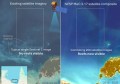
New Zealand’s emergency services are now able access to spatial data and aerial imagery online to assist with the clean up of the devastating earthquake last week.
The earthquake reached 7.0 on the Richter scale and caused NZ$2bn of damage, though nobody was killed.
The online service, developed by the Australian Research Collaboration Service and known as BeSTGRID, is normally used to share data between New Zealand research organisations.
But a number of agencies – including the New Zealand defence forces, Ministry of Civil Defence and Emergency, Environment Canterbury, New Zealand Aerial Mapping and Christchurch City Council – require secure access to vital information to assist more effectively with the disaster’s clean-up.
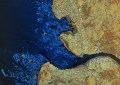
So a shared data area has been created to provide a single location where all information relating to the disaster can be accessed, including digital maps, aerial photography, and satellite images.
Because numerous aid workers without the correct credentials need access to the system, ARCS has provided temporary identities for those requiring them.
ARCS executive director Anthony Williams said the system will allow emergency responders to communicate better, collaborate easier and more effectively aid those in need.
“We’re happy to make ARCS identities available to those responding to the earthquake’s aftermath,” he said.