

Honeywell’s non-GPS navigation systems use live vision, star measurements and magnetic readings to help overcome the problem of GPS signal denial. Courtesy Honeywell.
Honeywell says it is now able to offer military grade aircraft navigation systems that do not rely upon GPS signals.
The company says its new “robust line-up of alternative navigation solutions” take inputs from a variety of non-jammable sources.
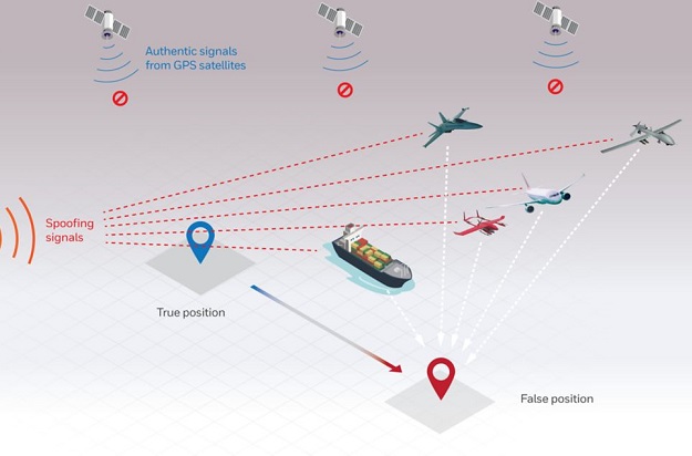
The products are intended for situations where “GPS signals are blocked, interrupted or unavailable”… something that is becoming increasingly likely in some of the world’s geopolitical hotspots.
GPS denial is “a minor inconvenience” for the public, “but for military operations, not having access to critical positioning and timing information can make or break a mission,” said Matt Picchetti, vice president and general manager, Navigation & Sensors, Honeywell Aerospace.
The alternative technologies on offer include:
- Vision-Aided Navigation, which compares a live optical or infra-red camera feed to reference maps to provide what the company claims is GPS-like accuracy.
- Celestial-Aided Navigation technology that takes the measured positions of stars and “reference objects” such as satellites and compares them to reference stars.
- Magnetic Anomaly-Aided Navigation technology that compares magnetic field measurements to magnetic data maps.
The company says prototype systems will be ready in 2022 with initial deliveries of production models expected in 2023.
Non-GPS navigation is making something of a comeback for use as a backup in case of GPS signal denial. For instance, the US Navy is once again training navigators in celestial navigation techniques.
Stay up to date by getting stories like this delivered to your inbox.
Sign up to receive our free weekly Spatial Source newsletter.


