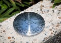
Nextcore’s RN100 LiDAR unit for UAVs. Image provided.
Nextcore has announced the next generation of its giant-killing, locally-developed LiDAR payloads.
Nextcore burst onto the Australian market in 2018 with a LiDAR sensor for UAVs with mouth-watering performance, but without the eye-watering price tag.
Originally developed by subsidiary Airsight for its own use, a novel engineering approach saw some most intelligent componentry choices in the Nextcore unit that enabled the new local player to cut the grass of the heavy-hitters in the miniature airborne LiDAR space.
The firm has just announced its new sensor, which incorporates the latest inertial navigation system from Australian company Advanced Navigation, the Certus Evo.
Nextcore claims that their implementation of this IMU with the Quanergy M8 Ultra laser scanner allows the system to be flown at higher altitudes than previous units, reducing scanning time and increasing the safety margin between the drone and obstacles on the ground. Nick Smith, co-founder of Airsight and Vice President Sales for Nextcore, said that up to 80 hectares can be scanned in a single flight and the RN100 is especially suited to steep, rugged terrain with thick vegetation.
“The RN series has been proven to withstand rugged environments, from the harsh environment of Northern Australia to difficult and challenging terrain across Asia. The custom software included with the system provides users with a combination of simple workflows and powerful levels of control of the survey data,” he said.
“We are utilising this technology in-house to improve our inspection times and coverage.”
Ashley Cox, COO of Nextcore said that the firm prides itself on is its heritage in operating this equipment in real-word situations.
“Our goals aren’t to achieve nice specification sheets but to produce reliable and realistic results at a fraction of the cost of comparable units,” he said.
“Our team have now achieved a breakthrough in recording accuracy and speed in the RN100, while maintaining the same packaging and total 2.2Kg weight.”
Stay up to date by getting stories like this delivered to your mailbox.
Sign up to receive our free weekly Spatial Source newsletter.