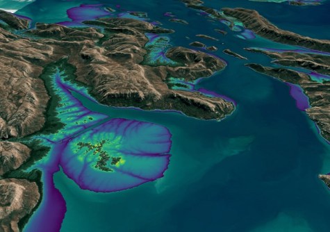
Digital Earth Australia (DEA) has released a new product suite called DEA Intertidal, which aims to help users visualise and study the boundary zone between sea and land and map it in multiple dimensions.
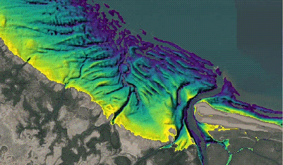
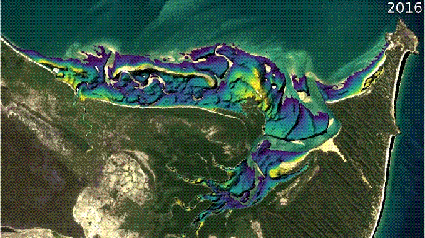
DEA Intertidal — the first DEA product to incorporate Landsat and Sentinel-2 data — provides an annual 10-metre resolution elevation product for mapping the changing elevation, exposure and tidal characteristics of Australia’s exposed intertidal zone.
“Our latest product suite adds a temporal component to the elevation product for the intertidal zone,” said Stephen Sagar, manager of the Coastal Environments team in DEA.
“That means DEA Intertidal will enable users to better monitor and understand some of the most dynamic regions of Australia’s coastlines.”
DEA Intertidal builds upon and supersedes earlier iterations of DEA intertidal products, such as the DEA Intertidal Elevation Model (also known as the National Intertidal Digital Elevation Model or NIDEM), which was the first 3D model of the nation’s intertidal zone.
The new product suite covers the whole continent and will enable researchers and environment managers to, for instance, integrate data into ecological models of relevance to the study of migratory birds, many of which make ‘stopovers’ on intertidal mudflats.
“Intertidal environments are diverse and contain many important ecological habitats such as sandy beaches, tidal flats, rocky shores and reefs,” said Claire Phillips, co-lead of the project, who noted that those environments also provide valuable benefits such as carbon storage.
DEA Intertidal will also be of assistance in understanding how the coastline changes over time.
“DEA Intertidal will provide baseline elevation data to monitor changing patterns of erosion and sediment movement, and coastal hazard impacts from extreme weather and inundation events,” said Robbi Bishop-Taylor, co-lead of the project from the Coastal Environments team in DEA.
Improvements over the earlier NIDEM include:
- The addition of Sentinel-2 data which improves the spatial resolution of the model to 10 metres, compared to the 25 metres of the original NIDEM.
- Incorporation of a new pixel-based method that supports a reduction in the temporal epoch of the product to 3 years (in comparison to 28 years in NIDEM), improving the ability to capture the current state of dynamic coastal environments, and enabling ‘change-over-time’ applications using annual epochs.
- Quantification of the vertical uncertainty of the elevation model.
- An Intertidal Exposure model at 10-metre resolution to examine the spatiotemporal patterns of exposure and inundation across the intertidal zone, supporting migratory species studies and habitat mapping applications.
- Tidal metrics to enable users to understand the varied ranges and distributions of tidal stages observed by the Landsat and Sentinel-2 satellites across Australia, and how this information can be used to better understand and interpret the products.
- The implementation of an ensemble tidal modelling approach, acknowledging the wide range of global and regional tide models available and their varying performance across different regions of Australia.
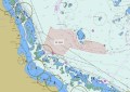
You can view a DEA Intertidal online interactive map here.