

When Cyclone Gabrielle hit the North Island of New Zealand in February 2023, it resulted in 11 deaths and a total damage bill of at least NZ$13.5 billion, the latter figure making it the costliest Southern Hemisphere cyclone in recorded history.
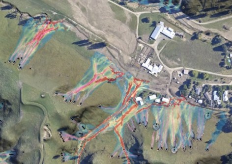
One of the major risks to life and property was the potential for rainfall-induced landslides. To assess the extent of the risk, an open-source software tool called RiskScape was pressed into service.
RiskScape can be used to gauge the potential for damage and loss to people and infrastructure from hazards such as volcanic eruptions, earthquakes, landslides, tsunamis and floods.
The software is used across the globe by land-use planners, asset managers, emergency managers and insurers.
With the cyclone approaching in February 2023, New Zealand’s Ministry of Business, Innovation and Employment (MBIE) and the Earthquake Commission EQC Toka Tū Ake, funded a trial development of a risk modelling dashboard to assist response efforts.
The team first created a landslide impact model, which enabled estimates to be made of the impact on properties, highways and the rail network. It then produced and issued twice-daily landslide forecasts.
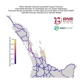
“RiskScape proved accurate, with initial residential claims similar to impact forecast spatial distribution and numbers,” said Dr Nick Horspool, Senior Risk Scientist with GNS Science Te Pū Ao.
“RiskScape is ready to provide evidence-based advice and modelling to help New Zealand avoid, mitigate or adapt to these hazards.”


