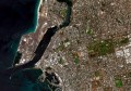
Maxar Intelligence’s latest WorldView Legion satellites have been lofted into orbit, boosting the company’s ability to collect 30cm-class Earth imagery.
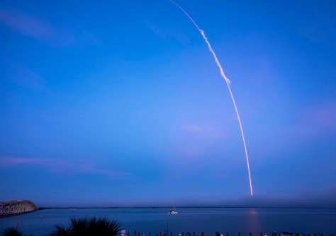
The fifth and sixth WorldView satellites were launched into mid-inclination orbit from Kennedy Space Center, Florida, on a SpaceX Falcon 9 rocket on 5 February, Australian time.
Maxar now has seven 30cm-class satellites in orbit.
According to the company, once all six of the WorldView Legion satellites are fully operational, the constellation will be able to collect more than 6 million square kilometres of Earth imagery per day, including up to 3.6 million square kilometres of 30cm-class imagery.
The satellites will further boost Maxar’s offerings by providing dawn-to-dusk image collection capabilities, thank to mid-inclination orbits and sun-synchronous orbits, as well as up to 15 revisits per day of some locations on Earth.
“This incredible achievement puts Maxar in a category of its own within the geospatial industry, and it’s been made possible thanks to the hard work, dedication and talent of the many people who have supported this program over the years,” said Dan Smoot, Maxar Intelligence CEO.
“This is the just the beginning. This additional capacity enables us to collect more timely data over more locations, and it will further fuel the industry’s most advanced 2D and 3D geospatial content products.”
“Combining this capacity with our AI-powered technologies and software platform puts Maxar in a unique position to deliver the ground truth in near real-time, empowering our government and commercial users to make mission-critical, time-sensitive decisions with confidence,” Smoot said.