

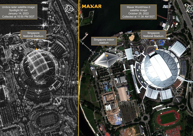
The Singapore National Stadium is shown in an Umbra SAR image on the left and a Maxar WorldView-3 satellite image on the right. Credit: Maxar Technologies and Umbra.
Maxar Technologies and Umbra have signed an agreement to that will give Maxar dedicated capacity from satellites in Umbra’s synthetic aperture radar (SAR) imagery constellation, with the data to be made available within Maxar’s portfolio of Earth Intelligence products and services.
The companies claim the combined offering will represent the most advanced multisource geospatial intelligence solution for a wide range of government and commercial missions.
“Maxar and Umbra are breaking new ground for the geospatial intelligence industry with this multisource offering — though optical and SAR imagery are highly complementary, collection management across these sources has historically been siloed,” said Dan Jablonsky, Maxar’s President and Chief Executive Officer.
“By integrating dedicated capacity from Umbra satellites into our secure ground infrastructure, we can help our Access customers derive real-time insights from the highest resolution electro-optical and SAR data in the industry.”
Umbra’s SAR satellites have licensed resolution down to 13 cm. The company’s SAR data will first be integrated into Maxar’s Rapid Access Program platform, which provides customers with a secure web interface to virtually task Maxar’s high-resolution satellites through on-demand access windows.


