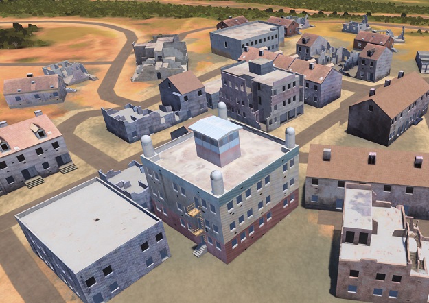
An example of the 3D terrain that Maxar produces to support a fully accessible virtual recreation of the physical Earth. Credit: Maxar Technologies.
Maxar Technologies has been awarded Phase 3b of the US Army’s One World Terrain (OWT) prototype Other Transaction Agreement contract.
The OWT program aims to deliver 3D global terrain capability and associated information services that support a fully accessible virtual representation of the physical Earth through the Army network.
OWT is a key component of the Army’s Synthetic Training Environment (STE), which aims to provide a realistic, common and automatically generated global geospatial dataset for simulation, mission command and intelligence systems to conduct collective training, mission rehearsal and mission execution at the point of need.
“The evolution of OWT shows how 3D terrain and information services are becoming essential tools for planning and decision-making not just for the US Army but for a wide range of military, civil and commercial institutions,” said Tony Frazier, Maxar’s Executive Vice President and General Manager, Public Sector Earth Intelligence.
In 2022, Maxar’s Phase 3a work focused on improving 3D terrain dataset fidelity and refining the automation processes to generate realistic terrain derived from the company’s satellite imagery for high-fidelity modelling and simulation systems, as well as terrain data export capability for operational Mission Command Information Systems.
In Phase 3b, Maxar will focus on enhanced conflation with open-source geospatial data and enhanced training areas using multisource collection, high-resolution insets.
The OWT prototype will evaluate the use of small unmanned aerial collections and the geo-registration of existing US Army terrain datasets.
The original OWT contract was awarded in June 2019 to Vricon, which was acquired by Maxar in 2020.


