Long-range dual sensor drone

By on 15 May, 2024

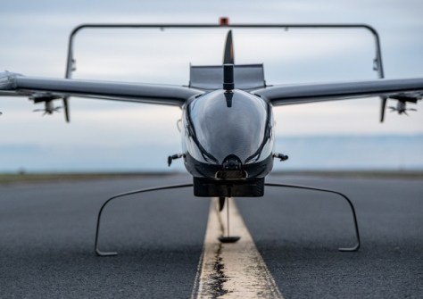
Carbonix, RIEGL and Phase One have announced the availability of what they say is the first fixed-wing VTOL integration of a long-range, dual-sensor system, using the RIEGL VUX-120 laser scanner and Phase One iXM 100 medium-format camera aboard Carbonix’ Volanti platform.

The system enables the capture of large-scale, detailed, colourised 3D models of infrastructure and terrain, and provides a scanning capacity of more than 12,000 hectares or a linear distance of up to 400 kilometres per mission.

You may also like to read:


, , , ,


Newsletter

Sign up now to stay up to date about all the news from Spatial Source. You will get a newsletter every week with the latest news.

GIS, AI to the rescue for the Great Barrier Reef
Australian researchers are designing a global real-time moni...
AI used to produce 30m-resolution global DEM
Fathom says the novel use of AI gives the most accurate publ...
Melissa Harris to head Geoscience Australia
Harris will become CEO of the geoscience agency in February,...
Topcon, FARO ink laser scanning agreement
The companies say they will develop laser scanning solutions...