

XGRIDS has launched the latest iteration of Lixel CyberColor Studio, version 1.7.0, following extensive real-world validation by industry experts around the globe.
The update makes Lixel CyberColor (LCC) Studio as one of the industry’s first mature and fully commercialised 3D Gaussian Splatting (3DGS) solutions designed to simplify high-quality, interactive and realistic 3D modelling for various industries.
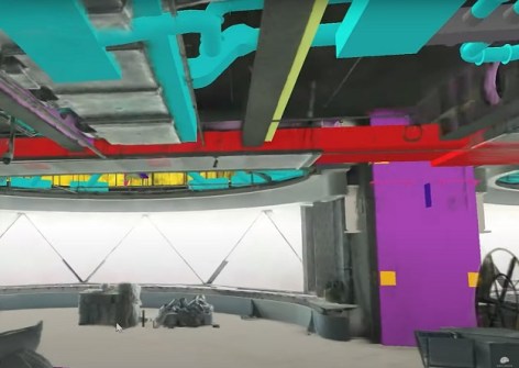
LCC Studio v1.7.0 integrates 3DGS technology with XGRIDS’ proprietary multi-SLAM algorithms, enabling users without specialised technical skills to easily capture, process and visualise highly detailed spatial environments.
Key new features of LCC Studio v1.7.0 include:
- The ability to merge multiple scanning sessions and integrate aerial and ground-level data into unified, coherent 3D models.
- Targeted high-definition rescanning capabilities that enhance detail clarity in large-scale scenes.
- Comprehensive developer tools and easy-to-follow documentation, supporting rapid integration into Unity, Unreal Engine, and Web environments.
LCC is optimised for industry applications such as architecture, engineering and construction; real estate visualisation; industrial digitisation and facility management; and cultural heritage preservation.


