

Experts from Toitū Te Whenua Land Information New Zealand (LINZ) have recently conducted work in Antarctica that will, amongst other things, help scientists monitor the effects of climate change.
The hydrographic, surveying and positioning team members undertook a range of activities aimed at maintaining the flow of key data, for which precise annual recalibration is required.
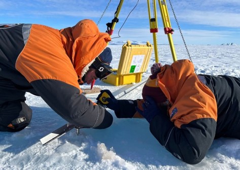
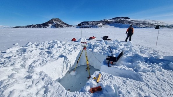
One task was to use GNSS equipment to calibrate tide gauges situated at Scott Base and Cape Roberts, the first step of which was to dig through the snow and drill through the ice to determine the water level.
“The Scott Base tide gauge is the world’s southernmost, and sensors at this location have measured Antarctic sea levels since 1957,” said LINZ Principal Geospatial Specialist, Dave Collett, who was this year’s field leader.
“The data contributes to research into climate change and sea level rise and is an important marker for sea level changes which may impact other parts of the world.”
Another of the team’s jobs was to prepare for the installation of SouthPAN reference station infrastructure near Scott Base next year.
“The Antarctic SouthPAN site will provide crucial updates on the status of satellites used by SouthPAN which allow users to position themselves more accurately,” said Collett.
LINZ has been involved in survey work to support science and operations in Antarctica since the 1950s. Its annual work program is supported by Antarctica New Zealand.
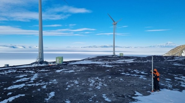
“Whenever our crew is down on the ice, our surveying experts take precise measurements of historic huts and wind turbines to measure ongoing movement of the structures in the permafrost,” said Collett.
“Monitoring of heritage huts is essential for their long-term preservation. The surveys help to show whether there is any risk to these historic structures from subsidence or other movements.”


