

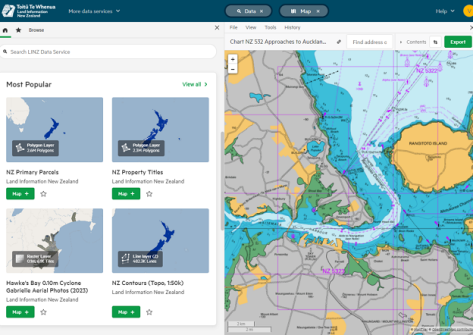
The Toitū Te Whenua Land Information New Zealand (LINZ) Data Service (LDS) website new has a new user interface, complete with new features and improvements.
According to LINZ, the new website design makes it easier for users to customise the web experience to their own needs.
New features of the upgrade include:
- the ability to curate a list of favourite datasets
- 3D data and visualisation capabilities
- the ability to create multiple map views
- the use of flexible workflows, such as cropping on data viewing or export
- support for accessing data on mobile devices.
“The new interface is the first significant upgrade to the look and feel of the data service in several years and it’s really exciting to be able to launch it today,” says Aaron Jordan, Head of Location Information Toitū Te Whenua Land Information New Zealand.
“The time was right to upgrade the technology for a more modern experience for our users. New features are going to enhance how users interact with the site and better support the way they work.
“Being so customisable is going to be a game changer for LINZ Data Service users.”
The LINZ Data Service website has more than 100,000 registered users who use such data as:
- aerial imagery
- elevation data
- topographic data
- hydrographic data
- property, boundaries and title information
- place names, street addresses and roads
- Crown land and properties managed by Toitū Te Whenua.


