

Australia’s Nick Brown explains the role and goals of the United Nations Global Geodetic Centre of Excellence.
The United Nations Committee of Experts on Global Geospatial Information Management (UN-GGIM) was established in 2011, as the apex intergovernmental mechanism for making joint decisions and setting directions with regard to the production, availability and use of geospatial information. The UN-GGIM is a subsidiary body of the United Nations Economic and Social Council (ECOSOC) and is composed of governmental experts.
In 2013 the UN-GGIM decided a draft resolution for a Global Geodetic Reference Frame was necessary, and in February 2015 the UN General Assembly adopted resolution 69/266, ‘A Global Geodetic Reference Frame for Sustainable Development,’ the first-ever resolution recognising the importance of a globally coordinated approach to geodesy.
Following this, the United Nations Global Geodetic Centre of Excellence (UN-GGCE) was established in 2022, with the objective of supporting, within available resources, the implementation of resolution 69/266. Its vision is a future “where all countries have strong political support for geodesy which enables them to — together — accelerate the achievements of the Sustainable Development Goals and derive social, environmental and economic benefits”.
In addition, the UN-GGIM has worked to establish the United Nations Global Geospatial Knowledge and Innovation Centre in Deqing, China, and the Kingdom of Saudi Arabia has committed to host and establish a United Nations Global Geospatial Ecosystem Centre of Excellence in Riyadh.
The UN-GGCE had its official an opening in March this year and is now operating from its office at the United Nations campus in Bonn, Germany. It is being paid for by the Federal Republic of Germany which, through an agreement with the United Nations, established a trust fund for the operations of the Centre.
Nick Brown has recently taken up the role of Head of Office for the UN-GGCE. Previously he was Director of National Geodesy at Geoscience Australia and co-Chair of the United Nations Subcommittee on Geodesy. We spoke with him to find more about his new job and to get an overview of issues confronting the global geodesy ecosystem.
Spatial Source: How did you become interested in geodesy?
Nick Brown: I wanted to be an astronaut when I was a kid. By the age of 12 I realised my eyesight was not good enough to be a pilot, but that didn’t stop my fascination with space and the universe. I spent many evenings sitting in my backyard with the telescope I bought with money from my paper round, staring at the Moon and Mars. I was curious about things like asteroids, gravity and Earth rotation. As you can tell, I was a very cool kid.
SS: Why did you make the move to the UN-GGCE?
NB: This is my dream job. For a long time, I have been advocating for greater recognition of the importance of geodesy. We hear a lot about the increasing value of geospatial information and significant growth that GNSS and Earth observation provides to gross domestic product. As part of these GDP assessments, the supply chain often starts with the GNSS and Earth observation satellites, moves through to service providers (eg. precise positioning services) and system integration providers who value add for specific industries (eg. agriculture).
In reality however, the supply chain comes back further to geodetic observations (eg. very long baseline interferometry, satellite laser ranging, gravimetry), data collection and data analysis. This data is then used to determine the Celestial Reference Frame, Terrestrial Reference Frame, Geopotential Reference Frame and Earth Orientation Parameters. These products are necessary for GNSS and EO satellites to function, but they are not widely recognised as being crucial to the supply chain and are therefore under resourced.
The UN-GGCE is the first dedicated resource to work with partners from member states and geodetic organisations to deal with these issues.
SS: Is global geodesy in good shape, or are there any pressing needs?
NB: There are pressing needs. In many countries there is either a lack of knowledge or lack of recognition on the importance of geodesy and our reliance on it for social, environmental and economic benefits. In some cases, weaknesses in the supply chain are not apparent thanks to the incredible work being done by organisations such as the International Association of Geodesy, whose members provide products and services based on in-kind contributions.
One of our roles in the UN-GGCE is to showcase the weaknesses in the global geodesy supply chain and highlight that the benefits countries gain from geodesy are not commensurate with how much they invest in it.
SS: Tell us more about those weak links.
NB: The supply chain we rely on to measure changes in the Earth’s shape, orientation, gravity field and movements of satellites, is weak. Much of the geodetic ground infrastructure we rely on is ageing and degrading. More than 50% of it is based on old technology. We need more, newer and better geodetic infrastructure.
A significant amount of the PNT information relied upon throughout the world is thanks to the incredible contributions from scientific organisations like the International Association of Geodesy (IAG). The IAG, however, does not have large budget. In fact, IAG is heavily reliant on contributions from Member State geodesy agencies, which allow their highly qualified staff to perform complex analysis in-kind to create the products and services we all rely on every day.
Governance is another weak link. There are currently few formal agreements in place that require governments to share and contribute geodetic information. Currently, much of the world’s geodetic infrastructure is operated by a ‘coalition of the willing’ in the academic realm which is hidden from government eyes. Contrast that with weather — the World Meteorological Organization has strong governance arrangements on sharing weather and climate information which means it is noticed (and adequately resourced) by Member States.
These weak links in the geodesy supply chain are putting the applications we rely on every day at risk of degradation, which in turn effects the accuracy and quality of our decision making. Can you imagine operating multi trillion-dollar industries on in-kind contributions, ageing infrastructure, and standards that are not fit for some users? We are, every day.
Weak links in the supply chain make it more difficult to:
- Monitor the precise orbits of Earth observation satellites, which impedes the accuracy with which we can measure sea level variations, ice loss and changes in the landscape.
- Measure and monitor time, which is critical for the GPS time synchronisation used to maintain cellular networks, financial transactions and power grids.
- Operate the almost three billion mobile phone applications that rely on PNT information, including providing navigation options including assistance to the blind.
SS: How will the UN-GGCE help global geodesy?
NB: The UN-GGCE team will be working across five focus areas:
- Improving the evidence that Member States need to quantify the importance of geodesy for societal and environmental benefits, and to enable them to develop strong business cases to improve weak links in the geodesy supply chain.
- Assisting countries in efforts to advocate for an increase in dedicated people and investment to achieve national, regional and global geodesy requirements.
- Strengthening international governance and institutional arrangements.
- Enhancing geodetic capacity and training opportunities within Member States, especially in developing countries.
- Improving awareness of the importance of geodesy by policymakers in Member States.
SS: How will you go about doing all this?
NB: We have three short-term working priorities. The first is a ‘Listening World Tour,’ a series of virtual engagements to listen to the Member States and geospatial organisations to better understand how we can support and assist them. This will be our way of introducing ourselves and listening to the needs of our stakeholders.
The second is to use information from the Listening World Tour and other sources to create a consensus-driven Global Geodesy Development Plan. This will outline global and regional user needs and provide guidance on how to address critical operational needs and gaps to assist Member States — particularly those in developing countries — to sustain, enhance, access and use the Global Geodetic Reference Frame (see below).
And thirdly, we will also be working with the UN-GGIM Subcommittee on Geodesy, Member States and international geodetic organisations to develop policy and educational communication materials to explain the importance of geodesy and the role it plays in our everyday lives.
SS: What is the role of the private sector in the geodesy ecosystem?
NB: The private sector largely sits in the portion of the supply chain that is recognised by the end user as being crucial, and the user is therefore happy to pay them for their products and services. For example, precision agriculture users will pay for a company to take raw GNSS data and turn it into a product that will enable the tractor to steer itself. What most precision agriculture users don’t know is that their service provider is benefiting from Earth Orientation Parameters (monitoring the dynamic motion of Earth in space) which are critical for position, navigation and timing applications.
The UN-GGCE’s motto is ‘Stronger. Together’. The UN-GGCE sees an opportunity to engage with these service providers to help explain the importance of the entire supply chain to governments, so they are appropriately resourced.
SS: Where would you like to see global geodesy being in 5, 10, 20 years?
NB: The change we need to see is the ‘operationalisation’ of geodesy. We need to improve global collaboration and coordination. We need stronger governance arrangements on the operation and performance of observational infrastructure. We need more (not less) geodesy education programs. And we need more resourcing for the people who are performing the geodetic observations, data collection and data analysis.
Ultimately, I would like to see the geodetic community move closer to the model of the World Meteorological Organization. Like geodesy, countries need to work together to measure and monitor the weather and climate. The WMO is well structured and operates very professionally to deliver services needed by countries for weather and climate. I envy their operating model (and their budget). Who knows, maybe in 20 years we will have a World Geodetic Organization.
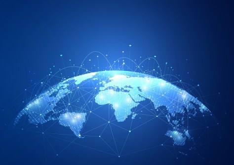
SS: What is the GGRF?
NB: The Global Geodetic Reference Frame (GGRF) is a collective term that encompasses a supply chain of:
- geodetic infrastructure (eg. GNSS, very long base-line interferometry, Satellite Laser Ranging, Doppler Orbitography and Radiopositioning Integrated by Satellite (DORIS), gravimeters etc.)
- data collection (eg. international and regional data centres)
- data analysis (eg. international, regional and national analysis centres)
- product development (eg. clock and orbit products, atmospheric models, gravity models)
- product transmission (eg. real-time data streams)
It also includes frames of reference:
- terrestrial reference frame (eg. realisations of the International Terrestrial Reference Frame)
- celestial reference frame (eg. realisations of the International Celestial Reference Frame)
- geopotential reference frame (eg. realisations of the Earth Geopotential Model)
Finally, the GGRF depends upon the capacities and capabilities residing in Member States and organisations (such as the services of the International Association of Geodesy) to perform the work in the global geodesy supply chain to analyse, compute, create and sustain the frames of reference.


