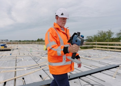
INTERGEO, which takes place every year in Germany, is billed as the world’s largest exhibition for the surveying and spatial sector.
Held this year in Munich, the three-day event brought together hundreds of exhibitors and many thousands of delegates, all eager to either show off the latest gadgets or get their hands on them.
The following is a brief rundown on some of the new equipment on show at INTERGEO this year, a lot of which is LiDAR-based.
Schneider Digital showed off its 3D PluraView (a 3D monitor for precise stereoscopic work with aerial imagery, point clouds, mapping projects, and 3D city models), 3D GlobeView (immersive 3D stereo visualisation on a large format display) and ImmersaXR-Studio (software for visualising complex geospatial data, point clouds, 3D city models and BIM models).
NavVis had its new CLX handheld reality capture scanner on show, as well as is cousins the MLX and VLX.
SingularXYZ demonstrated its Seshat LiDAR and visual GNSS receiver, which integrates cm-level GNSS RTK positioning, visual perception, LiDAR scanning and intelligent fusion algorithms into one solution.
Trimble launched its new ST30 smart target, which integrates a 360-degree prism, IMU, GNSS receiver, tilt compensation and automated rod height functionality into a single device.
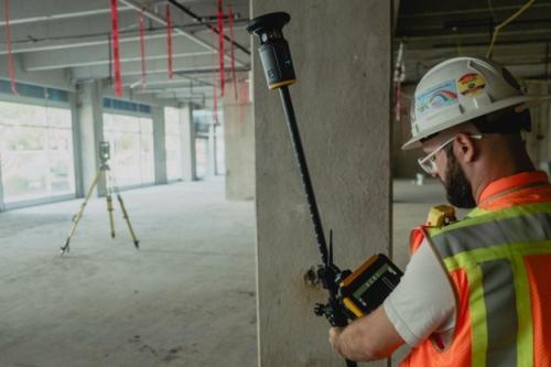
Another launch was the Tarrius range of surveying gear. The units include the TR10 visual AR stakeout with calibration-free tilt compensation, the TR12 with added dual cameras and an integrated laser rangefinder, and the TR12B with a dedicated base station option with a built-in 5W UHF radio.
Hesai Technology unveiled its MT series LiDAR, which, it says, packs an ultra-small beam spot, ultra-high ranging precision of 3.5 mm, and cumulative scan densification, into what the company says is the smallest form factor in its class.
Callian has released three new antenna solutions for geospatial and defence operations: the Accutenna 4 (AC4) pole mount antenna (AC4990PXF), the latest pole-mount controlled reception pattern antenna (CR8894PXF+), and the AJ979XF+-MAR full-band anti-jamming antenna.
Sokkia released a range of new products, including the GCX5 and GRX7 GNSS receivers, each of which support RTK positioning through the Topnet Live correction network, have anti-jamming and anti-spoofing capabilities and support tilt compensation of up to 60 degrees.
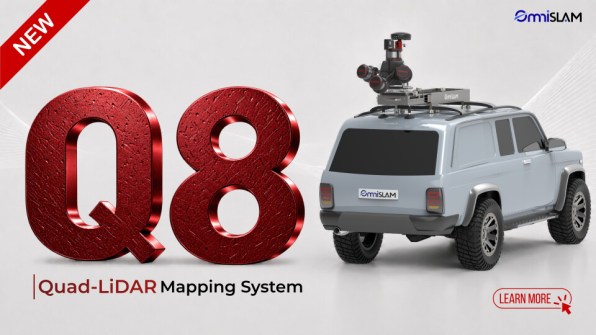
OmniSLAM showcased its recently launched OmniSLAM Q8 vehicle-mounted fixed quad LiDAR, and a new prototype called the OmniSLAM R15, a mobile scanner that has a 1550 nm laser sensor and 8K panoramic camera.
Sokkia also launched its Shared Reality portfolio, which includes the SRS1 and SRS2 handheld scanners. The SRS1 is designed for single-operator data collection and supports multiple configurations (e.g. handheld, front-pack, vehicle-mounted) for infrastructure, urban mapping, construction, forestry and other geospatial applications. The SRS2 is designed for mobile data capture in environments with limited features or reduced positioning availability, using uses localisation-fusion SLAM technology.
And GeoCue announced the TrueView 550 addition to aerial LiDAR portfolio. The unit combine next-generation LiDAR, dual 20 MP cameras with an expanded field of view, and a choice of navigation systems.