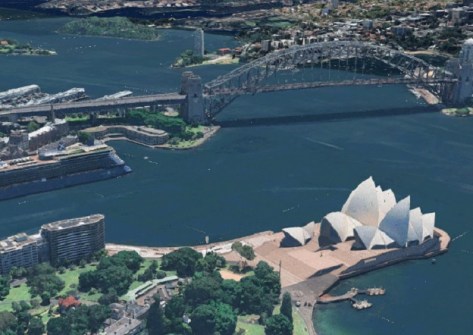
Esri has announced a collaboration with Google Maps Platform under which Google’s Photorealistic 3D Tiles will be integrated into the ArcGIS suite.
The company says this integration will enable users to produce richer maps, scenes and supporting analytics across a variety of applications such as urban planning, real estate and public sector infrastructure projects.
“Users have long sought more detailed and photorealistic 3D basemaps,” said Deane Kensok, ArcGIS Content CTO at Esri.
“This 3D basemap will be a valuable addition to our basemap collection, providing a more realistic and detailed view of metropolitan areas for large parts of the world.
“It can be used on its own or seamlessly integrated with users’ data, enhancing the visual context and enabling more detailed and accurate analysis.”
The 3D Tiles will be available to ArcGIS users by Q3 of 2025, covering 2,500 cities in 49 countries.
“We know creators and developers across platforms want rich, photorealistic 3D visualisations and that is why we are excited to bring Google Maps Platform’s Photorealistic 3D Tiles to ArcGIS,” said Eugene Yeh, Director of Go-to-Market for Google Maps Platform.
“We look forward to seeing how Esri’s global community of geospatial professionals uses 3D Tiles to enrich their understanding of the world.”


