©stock.adobe.com/au/structuresxx
The future of positioning, navigation and timing systems were on the agenda at the IGNSS conference.
By Jonathan Nally
Members of the GNSS community gathered at the University of NSW in December for the 2022 IGNSS Conference, organised by the Sydney-based IGNSS Association, a not-for-profit international association comprising around 1,500 academics, industry partners and professionals.
This was the first time that participants had been able to gather in person since the COVID epidemic really got going, and it was clear from the atmosphere that people were glad to be mingling and networking face to face again. There was a definite buzz of enthusiasm throughout the whole three days of the conference, and it was great to see representatives attending from Australasia, Asia, the USA and beyond.
The event was a technical forum focused on developments in GNSS technologies and services, PNT (positioning, navigation and timing) overall, and potential alternatives to GNSS. It also left Earth orbit and pondered the need for PNT services on the Moon and in lunar space. The theme of the conference was ‘Look UP, Look OUT — GNSS Horizons’.
In his welcoming remarks, Craig Roberts said that “What we’re trying to do is encapsulate the fact that PNT is starting to grow up — it’s not a teenager anymore. We’re starting to reach out more and expand to a growing range of applications. So what we do is having an impact more broadly.”
Concurrent sessions meant it was not possible to attend every lecture, but the following is a summary of two of the major sessions that caught my attention.
PNT in Australia
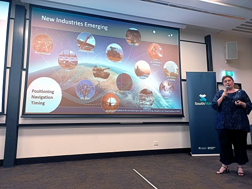
The first major session covered PNT and related issues within Australia. Elizabeth Pearce from the Australian Space Agency spoke about the development of Australia’s PNT Roadmap, the publication of which was imminent at the time this issue of Position went to press. Pearce explained that the ASA has seven priority areas and is in the process of producing roadmaps for each of them. Three have been published already – communications, robotics and Earth observation. PNT is next.
Pearce explained that PNT is at the heart of both terrestrial and space operations, from secure communications to timing synchronisation, space situational awareness to ionospheric monitoring, astronaut positioning (for search and rescue) to SLAM for robotics, Earth observation, lunar operations, and many more emerging fields.

Elizabeth Pearce from the Australian Space Agency spoke about the soon-to-be-released PNT Roadmap.
The ASA has collaborated widely with industry (41 businesses in total), government (55 agencies) and academia organisations (16) in the development of the PNT roadmap (and other roadmaps), without which the work would not have been possible.
It’s fair to say that the Australian geospatial sector is eagerly awaiting the publication of the PNT Roadmap, so stay tuned for coverage when that happens.
The next speakers were from Geoscience Australia (GA), who covered a range of topics. Martine Woolf, the head of GA’s Positioning Australia Branch, gave an overview of developments in the Positioning Australia program over the past few years. Woolf pointed out the range of needs for reliable and accurate positioning, including the use of GNSS by GA to undertake mm-level modelling for Australian tectonic plate research.
Four years ago, the federal government made a major investment, averaging to about $86.3 million in funding for two major programs, being the Better GPS for Regional Australia program, which will see down to 10cm positioning available anywhere across the continent and offshore, including a safety-of-life certified service; and the Better GPS to Support Australian Businesses program. The latter will “enable 3cm- to 5cm-accurate positioning capability, anywhere in areas with mobile phone coverage or internet [access],” Woolf said. “This also includes investment in open source tools and software to deliver positioning services.”
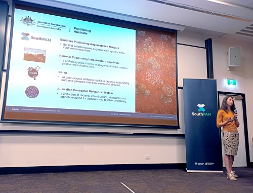
Woolf then spoke about SouthPAN, the first government-owned satellite-based augmentation system in the Southern Hemisphere, designed to improve on standalone GNSS services. SouthPAN promises to be game-changer for a wide range of applications, from farming to transport to public safety and more.
Ryan Ruddick, Director of GNSS Infrastructure and Informatics at GA, then spoke about the national positioning infrastructure capability, which provides a unified approach to the management of Australia’s positioning infrastructure. This goes together with Ginan, the open source software toolkit that processes multi-GNSS data.

Anna Riddell from Geoscience Australia gave an update of Australia’s geospatial reference system.
Anna Riddell, a GA geodesist, gave an update on Australia’s geospatial reference system, which is fundamental to the ability to deploy new positioning technologies in Australia and get the benefits of cm-level positioning, without which the other systems would not be possible.
Other sessions on the first day covered PNT developments in Japan and Europe; the application of GNSS in disaster response, weather forecasting and land surface movement research; developments in receiver technology and anti-jamming systems; and many other terrestrial and space applications from both Australia and abroad.
PNT from LEO
A highlight of the second day’s presentations was a panel session on PNT in low Earth orbit (LEO). The panel comprised four international experts. Zak Kassas is a Professor in the Department of Electrical and Computer Engineering at The Ohio State University, and the director of CARMEN, the Center for Automated Vehicle Research with Multimodal AssurEd Navigation. Joshua Morales is currently a principal and co-founder of StarNav LLC, producing PNT receivers using ambient radio signals as a backup to GPS. Patrick Diamond is the CEO of LEOPNT. And Bryan Chan, who joined the session remotely from the USA, is the Vice-President of Business Development and Strategy at Xona Space Systems.
Diamond, who has worked extensively with US government agencies, pointed out that in the US there are 16 critical industry sectors that depend on GNSS services, primarily the timing signal. It has been estimated that, if the PNT system were to fail or be attacked, it would cost the US economy around US$10 billion per day in damages and disruption. Just think of the delivery services sector alone, which is heavily reliant on positioning services — could they go back to printed street directories if the GNSS system was denied?
Chan pointed out that as recently as three years ago, PNT and LEO didn’t really go together. But that has changed. He spoke about how his company is trialling PNT services from a test satellite that’s in orbit right now. Chan said that Xona Space Systems is taking the approach of, “What if we could invent GPS today, from scratch? That’s what we’re taking a really hard look at.”

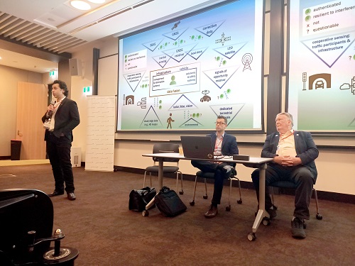
The ‘PNT from LEO’ panel session included Zak Kassas (standing), Joshua Morales (centre), Patrick Diamond (right) and Bryan Chan (not shown, on a remote connection).
Several of the speakers, as well as several questioners from the audience, spoke of their concern about the vulnerability of modern society to disruption or denial of the GNSS system… even going so far as to say that it could have been a mistake for the US military to have made GPS available to non-military users — doing so has brought on a reliance on a service that could be denied to civilian users in the event of a major conflict. There’s also the question of sovereign risk — countries such as Australia are dependent on satellite services provided the US, Europe, China, Russia and now Japan. What would happen if access were denied or withdrawn for some reason?
Could PNT services from new constellations of inexpensive satellites in LEO (as opposed to mid-Earth orbits) be the answer? Very possibly, but such a system would have its own vulnerabilities. Kassas raised the hypothetical problem of the Kessler syndrome. This is where space junk collides with satellites, producing more space junk, which then collides more with satellites, and before you know it you have a runaway chain reaction that would result in a debris cloud encircling the Earth. Such a scenario would see major destruction of orbiting assets and the denial of entire orbital altitude bands for decades to come.
One thing is clear — urgent steps need to be taken to improve the robustness and redundancy of global PNT systems, otherwise we could just be asking for trouble.
Going beyond Earth
The Conference also featured a lot of presentations about emerging uses of PNT and GNSS in the space domain, including plans for establishing a kind of ‘lunar GPS’ for upcoming missions to the Moon. This was the stuff of science fiction when I was a young lad, so it was somewhat surreal to hear it described and spoken of in such a matter-of-fact manner. The next few decades are going to be a brave new world of exploration beyond the Earth, and PNT technologies and services are going to be front and centre of those missions.
Overall, the 2022 IGNSS Conference was a very enjoyable and enlightening experience, with something of interest for everyone — whether that was policy matters, technical developments or research applications. The event is normally held every two years, and I can’t wait to find out about the latest developments the next time the conference comes around.


