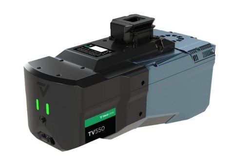
GeoCue has released the TrueView 550 high-performance aerial LiDAR mapping system.
According to GeoCue, the TrueView 550 combines next-gen LiDAR, dual 20 MP cameras, an expanded field of view and choice of nav system.
The company says the unit is engineered for aerial surveying applications ranging from traditional topographic mapping to challenging, high-relief terrain.
Ranging capabilities of up to 2,100 metres and typical flight altitudes ranging from 100 to 600 metres AGL are supported, giving operators greater flexibility when planning projects over varying terrain and larger project areas.
The LiDAR scanner is capable of collecting up to 1 million points per second at 120 metres AGL, providing the detailed 3D information required for professional mapping applications.
The TrueView 550 incorporates two 20 MP global shutter mapping cameras, providing an ultra-wide imaging field of view and expanding the amount of visual information captured during each flight.
The dual-camera configuration is designed to improve point-cloud colourisation while providing high-resolution imagery that gives users additional visual context for feature identification, inspection and deliverable creation.
Customers can configure the mapper with either GeoCue’s TrueNav GNSS-Inertial navigation system or upgrade to the Applanix APX-20 GNSS-Inertial navigation system for enhanced positioning performance.