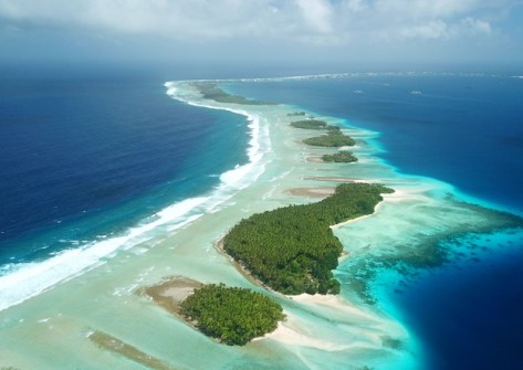
Fugro has been awarded a contract by The Pacific Community (SPC) to acquire and process high‑resolution coastal data across exposed outer islands in Tonga and the Republic of the Marshall Islands.
The aim of the project is to improve national decision-making capability and strengthen local ownership of climate risk information.
The initiative is supported by funding from the Green Climate Fund and the governments of Australia and New Zealand.
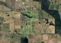
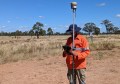
Fugro will deploy its RAMMS airborne LiDAR and imaging system, plus analysis tools, to deliver high-resolution coastal intelligence data.
The result will be authoritative baseline information on coastal exposure, inundation pathways and future hazard scenarios.
“This investment blends multiple national and regional priorities, bringing together, among others, the Marshall Islands’ Strengthening Manit to Address Loss and Damage project supported by MFAT, and the SPREP‑led Weather Ready Pacific programme,” said Hervé Damlamian, Team Leader Oceanography at SPC.
“It delivers the critical coastal baseline data needed to enhance early warning systems and to enable risk‑informed, resilient planning in both countries.”
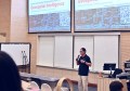
Fugro will also work with SPC to implement a capacity building program to equip local technical teams with the skills needed to interpret, maintain and apply the datasets within national planning systems.
Paul Seaton, Fugro Director for Climate & Nature (APAC), said that “by deploying RAMMS, we can map hazardous shorelines quickly and with the precision planning authorities require”.
“Just as importantly, we’re investing in local capability, so this knowledge stays in the region.”