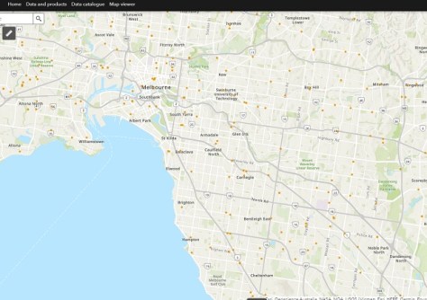
The public-facing Beta version of the Digital Atlas of Australia went live on 30 June 2023, enabling users anywhere to take advantage of the many options it offers.
The Atlas brings together a range of ‘trusted national datasets’ from across government and presents them on an interactive online platform.
The Atlas, which is based upon an ‘Integrated Geospatial Infrastructure,’ aims to connect data “across borders to transform and streamline how we connect, manage and use data. This infrastructure will move us from data swamps and silos to a digital ecosystem enabling seamless integration, sharing, and analysis of location data.”
The initiative was introduced as a result of two strategies outlined in the Federal Budget 2021–22 — the Digital Economy Strategy and Australian Data Strategy, which, together, aim to “transform Australia into a modern and leading digital economy by 2023 and focus on improving the accessibility and discoverability of the wealth of data held by Commonwealth organisations”.
In a statement issued in May 2021, Dr James Johnson, CEO of Geoscience Australia, said that the new platform “will embed analysis tools that allow anyone to explore, graph, analyse and compare information that meets their needs in their neighbourhood and across the country”.
“For example, a business will be able to explore and download demographic profiles of towns and regions, along with information on infrastructure, to determine the most commercially-viable places to set up new outlets, anywhere in Australia — making virtual design and planning possible without even having to visit the site.”
The Atlas has been operating for a few months with access restricted to a limited number of government users. But with the Beta version now live, anyone can jump online and try it out.
The Atlas groups data into a number of different themes:
- Administrative boundaries
- Buildings and settlements
- Land cover and land use
- Physical infrastructure
- Population distribution
- Transport and transport infrastructure
- Water bodies
Data will also be discoverable according to specific ‘initiatives,’ the first of which is bushfire intelligence, which brings together a new Historical Bushfires dataset and a range of interactive products to support bushfire research, national emergency management and risk management.
Further data will be added to the Atlas over the next two years, with final operating capability due in June 2025.
The following video provides a deep dive into the Atlas, how it came about and what it offers.


