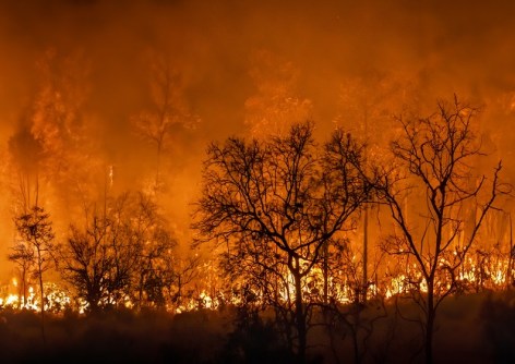
Data visualisation and mapping have a vital role in preparing for and responding to hazards and natural disasters.
By Christophe Lienert and Jie Shen
Information and warnings are decisive elements in the field of integrated risk management. Warnings increase preparedness and are one of the organisational measures (along with forecasts and emergency planning) for responding to hazards and risks.
Near-real-time data and warnings need to be available, accessible, communicable and understandable, and must be issued and distributed according to the needs of various target groups. User-centred, impact-based warnings aim to complement meteorological forecasts with impact forecasts. This requires a dedicated collaboration between meteorological services, warning services and user groups.
Visualisation, communication, and information management are crucial for effective forecasting, nowcasting, and warning systems and thus are the key to better disaster prevention and management. Cartography and geo-visualisation, in general, offer various means for this. Today’s maps are almost entirely digital: web-based, interactive and updated in real time. However, visualisation of spatiotemporal data streams and impact-based warnings comprise maps and full geoinformation systems, including digital twins and multimedia.
Yet there are still open questions that remain to be discussed and answered regarding user-centred information management, large data processing, visualisation, and communication of operational consequences. As well, there are the humanitarian and economic impacts of natural hazards, visualisation of uncertainties, and other perspectives coming from geovisualisation, cognitive visualisation, GeoAI, interoperability of systems, standardisation of processes, distribution channels of early warnings, and early action.
Many organisations have had interest in applying cartography and geographic information systems for early warning and crisis management, including the International Cartographic Association (ICA). At ICA, activities around the topic ‘cartography in early warning and crisis management’ (CEWCM) resulted in the establishment in 2005 of a working group and, in 2007, a formal ICA Commission devoted to the topic (https://cewcm.icaci.org).
During the last 20 years of commission activities, several well-cited publications have been created from conferences and workshops and links have been established to other research organisations and organisations within the United Nations system. The topic of early warning has moved very high on the agenda of the UN and the ICA is contributing to this work through the CEWCM commission.
The Commission is concerned with the concepts, models and standards for the cartographic visualisation of early warning, disaster management, monitoring and resilience. Another important topic is the integration of spatiotemporal information and related data in humanities and social sciences with thematic data for disaster detection, early warning, monitoring, damage assessment, response and training/education.
From a technical point of view, the development of technologies in the field of big data analysis, social computing, coherent and timely information distribution technologies (e.g. cartographic APIs), crowd-sourcing and artificial intelligence technologies for early warning and crisis management are deemed important to the current leadership of CEWCM.
Further research and application touchpoints addressed by the Commission include:
- The study, discussion and comparison of hazard zone, vulnerability and exposure maps for hazards such as fires, cyclones, floods, droughts, volcanoes, earthquakes, infectious diseases, etc, and for the identification and assessment of potential risk and disaster zones.
- Fostering high-quality mapping and cartographic modelling, including visualisation and dissemination technologies, geospatial process and publishing tools, for early warning and crisis management.
- Providing methodological and technical inputs and advice for efficient technical systems for risk reduction and increase of resilience: monitoring, multi-hazard early warning systems, impact assessment, and risk-based decision-making.
- Promoting the development of disaster management plans for pre-, during and post-disaster situations and enhancing support for early warning systems, emergency events mitigation and decision making.
- Developing technical training and know-how transfer about emergency geospatial information for partners and developing countries.
To further these objectives, international workshops and conferences are held on selected aspects of cartography and GIScience in early warning and crisis management. We encourage everyone with an interest in this field to become a commission member and/or attend one of our conference and workshop events.
Upcoming events with ICA CEWCM Commission-supported activities.
RIMMA 2025
- 28-31 Jan 2025, Bern, Switzerland
- https://www.rimma2025.org
- The interdisciplinary international conference series on Risk Information Management, Risk Models and Applications.
ICC 2025
- 16-22 Aug 2025, Vancouver, Canada
- https://icc2025.com
- The 32nd International Cartographic Conference will be co-located with the 2025 Geo-Information for Disaster Management conference.