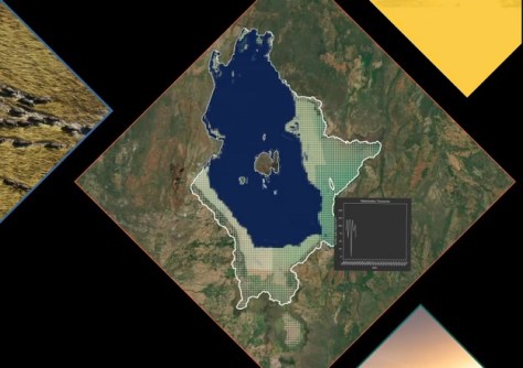
Digital Earth Africa has launched a new Waterbodies Monitoring Service, which brings together more than 40 years of satellite observation data on over 700,000 separate water bodies across the continent.
With a weekly update cadence, the service maps changes in the size (surface area) of waterbodies such as lakes, ponds, man-made reservoirs, wetlands and segments of river systems.
The result is a highly valuable time series for each individual waterbody.
The service enables users to:
- Understand and gauge water availability
- Optimise water storage
- Identify solutions for supporting water security
- Obtain insights into floods and droughts
- Identify long-term patterns
- Identify places and people at risk from water-related disasters
- Identify ecosystems at risk from water scarcity
- Assess water availability for farming
“The service has been developed to support Africa’s governments, policymakers and key private sector actors in undertaking insightful planning, adopting critical risk mitigation strategies, and proactively managing Africa’s settlements, cities, communities, and livelihood activities which are dependent on, or adjacent to waterbodies,” said Dr Lisa-Maria Rebelo, Digital Earth Africa lead scientist.
The Waterbodies Monitoring Service can be accessed in three ways: via an API, through the Digital Earth Africa interactive maps platform or via the sandbox analytical environment.
Digital Earth Africa is the world’s largest operator of the Open Data Cube infrastructure, providing a free platform for accessing satellite imagery specific to the African continent
The establishment of Digital Earth Africa was funded by The Leona M. and Harry B. Helmsley Charitable Trust and the Australian Government. It is based on Geoscience Australia’s highly successful Digital Earth Australia program.


