

From left: Ian Simpson, GNS Science; Gaye Searancke, Toitū Te Whenua; Dr Rob Murdoch, Institute of Water and Atmospheric Research; and Jamie McMichael-Phillips, The Nippon Foundation-GEBCO Seabed 2030 Project.
New Zealand has become the first government to sign up to the exciting and ambitious The Nippon Foundation-GEBCO Seabed 2030 Project.
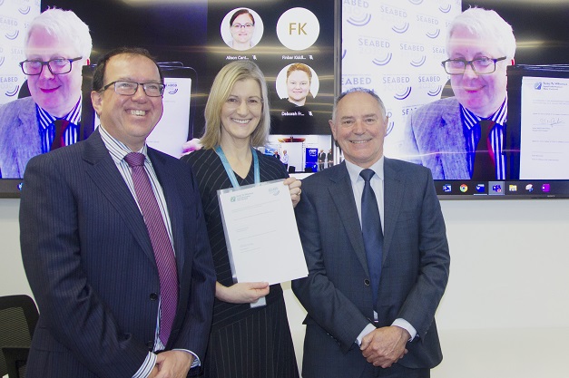
The Chief Executive of Toitū Te Whenua Land Information New Zealand, Gaye Searancke, signed the Memorandum of Agreement on behalf of New Zealand, with Jamie McMichael-Phillips, Seabed 2030 Director, linking in by video from the UK, signing on behalf of the Project.
Toitū Te Whenua, National Institute of Water and Atmospheric Research (NIWA) and GNS Science are working together to jointly govern data assembly and coordination in the region.
“New Zealand is proud to be leading the way with this work,” said Searancke.
“Mapping the seabed floor is critical to our knowledge about climate and weather patterns, tides, wave action, sediment transport, tsunami wave propagation and underwater geo-hazards.”
“While good progress is being made to meet the 2030 target, the Memorandum of Agreement marks a significant step forward,” added NIWA Environmental Management Programme Leader, Kevin Mackay.
Seabed 2030 is a collaborative project between The Nippon Foundation and the General Bathymetric Chart of the Oceans (GEBCO) aimed at compiling all bathymetric data into the freely available GEBCO Ocean Map.
GEBCO is a joint project of the International Hydrographic Organization (IHO) and the Intergovernmental Oceanographic Commission (IOC), and is the only organisation with a mandate to map the entire ocean floor.
GNS Science Crustal Geophysics Team Leader, Vaughan Stagpoole said that GNS Science is pleased to be involved.
“As Aotearoa New Zealand sits on top of the mostly-submerged continent of Te Riu-a-Māui/Zealandia, ocean science is really important — so we can understand global-scale environmental change, natural hazards and sustainable resources.
“Just as topographic maps help our land-based science, bathymetry is vital for our marine projects. Our seabed is less known than the surface of Mars, and this will be the decade to improve on this.
“This agreement is a major milestone and it will lead to better outcomes for Aotearoa New Zealand and the Asia-Pacific region, greater understanding of hazards, important new ocean discoveries and a more sustainable and resilient future,” added Stagpoole.
The Memorandum of Agreement covers working to advance our understanding of ocean bathymetry and complements the United Nations Decade of Ocean Science in Support of Sustainable Development.
Seabed 2030 is also one of the first actions officially endorsed as part of the UN Ocean Decade.
“The New Zealand signing is significant for Seabed 2030 as it’s the first full Memorandum of Agreement between a Government and the Project,” said McMichael-Phillips.
“As a host of one of our regional centres, New Zealand has provided steadfast support to Seabed 2030 from the outset and we look forward to building on our collaboration in the race towards achieving our mission.
“We call upon other countries to join us in our goal of a complete map of the ocean floor — an apparatus which will help us better understand planet Earth.”
Stay up to date by getting stories like this delivered to your inbox.
Sign up to receive our free weekly Spatial Source newsletter.


