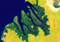
Aerial Acquisitions have begun to fly several regional towns and centres in NSW, and have so far captured high-resolution imagery for Armidale, Batemans Bay, Foster, Broulee, and Narooma. The GSDs for the imagery in these areas is between 6.5 and 10 cm.
The company is currently working on a cost-sharing model, where it will sell its imagery to local government and certain rural users for cost. Estimates for a small town are about $5,000 delivered, and about $10,000 for a large urban centre, and are negotiable.
The company is hoping to fly most towns/centres in NSW, but is looking for expressions of interest from regional towns and centres, so as to prioritise their flights. They aim to update the imagery yearly or every couple of years.
You can sample the Narooma imagery online at http://www.realsauce.com.au/aerial/narooma/ (click RealSauce tab) Note that this a beta test by a company interested in the imagery, and that the colour balance isn’t 100% and that there are a few missing tiles.
Erron Gardner, director of Aerial Acquisitions, has offered to send out the 6.5 cm GSD Narooma ECW to anyone that wants to see a full-resolution sample.
Aerial Acquisitions are happy to fly towns obligation-free, and will provide the imagery for evaluation before selling at cost. The company is starting in NSW, but will eventually move out to the rest of Australia, so let Erron know if you want the company to cross the border into your state.
If you are interested in seeing the sample, or having your area flown, please contact Erron Garnder on (02) 9594 5527 or 0447 440 234, or visit www.aerialacquisitions.com.au.