The 2024 edition of the International Conference on Geographical Information Systems Theory, Applications and Management (GISTAM 2024) aims to create a meeting point of researchers and practitioners that address new challenges in geo-spatial data sensing, observation, representation, processing, visualization, sharing and managing, in all aspects concerning both ICT as well as management information systems and knowledge-based systems.
The conference welcomes original papers of either practical or theoretical nature, presenting research or applications, of specialised or interdisciplinary nature, addressing any aspect of geographic information systems and technologies, such as:
- Data acquisition and processing
- Remote sensing
- Interaction with spatial-temporal information
- Spatial data mining
- Managing spatial data
- Modelling, representation and visualisation
- GIS and climate change
- Domain applications

The Geospatial Council of Australia’s World Hydrography Day Seminar will dive deep into the latest advancements in hydrographic surveying, mapping technologies and data analysis techniques.
The event will give delegates the opportunity to connect with fellow professionals, share experiences and learn from industry leaders at the forefront of marine charting and exploration.
For both seasoned experts and those just starting out in the field, the event promises invaluable insights and networking opportunities to enhance skills and advance careers.
Image credit: ©stock.adobe.com/au/HENADZ

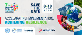
The United Nations Committee of Experts on Global Geospatial Information Management (UN-GGIM), in collaboration with the Government of México through Instituto Nacional de Estadística y Geografía (INEGI) will convene the Seventh High-level Forum on United Nations Global Geospatial Information Management with the theme ‘Accelerating Implementation: Achieving Resilience’.
This seventh edition of UN-GGIM’s High-level Forums will continue UN-GGIM’s regular high-level, multi-stakeholder discussions on global geospatial information management, through the convening of global forums, aimed at promoting comprehensive dialogue among member states, and between member states and relevant international organisations, UN system entities and stakeholders.


