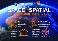
During 2020 an expert group drafted the SPACE+SPATIAL Industry Growth Roadmap 2030 – a national snapshot for Australian professionals to better understand the bold new future that’s rapidly approaching and what it means for them, their careers, their organisations and all of Australia.
The National Steering Committee is seeking feedback on the Roadmap from spatial professionals of all levels across the country. There are a number of ways to get involved, one of which is to participate in this SSSI and SIBA|GITA SPACE+SPATIAL Roadmap Online Session.
You will hear about the key plans, activities and issues and have the opportunity to have a meaningful discussion with colleagues about your thoughts on the Roadmap Consultation Paper and the topic in general.

The Tasmanian Spatial Information Council (TASSIC) will hold a Geospatial Workforce Development Forum on 9 November 2023, to help shape the future of the geospatial sector in Tasmania.
The Forum will bring together key stakeholders from education, employers, government and suppliers to address critical challenges and opportunities facing the sector.
The Forum will include presentations from representatives of industry, government and the education sector, as follows:
- Paul Digney (Jacobs)
- Rob Rowell (Insight GIS)
- Ben Morris (Local Government Association of Tasmania)
- Michael Krome (Australian Spatial Analytics)
- Arco Lucieer (University of Tasmania)
- Sam Ebert (TAFE NSW)
- Troy Robbins (TasTAFE)
The event will conclude with a moderated discussion session led by Danika Bakalich (Geospatial Council of Australia).
The Forum will be a hybrid event with both in-person and online attendance options available, and it will employ the Menti-Meter program to facilitate discussions, ensuring that each delegate’s voice is heard and their input valued.
Image credit: ©stock.adobe.com/au/borisblik

GeoBuiz Summit is an annual international conference focused on the geospatial industry, which encompasses a range of technologies and applications related to mapping, location-based services, and spatial data analysis.
The summit brings together industry leaders, government representatives, experts, and innovators to discuss the latest trends and innovations in geospatial technology and applications.
The conference covers a range of topics, including geospatial infrastructure, mapping and surveying, satellite imagery and remote sensing, location-based services, smart cities and urban planning, and much more. The GeoBuiz Summit aims to promote collaboration and knowledge-sharing within the geospatial industry and to showcase the latest developments in this exciting and rapidly evolving field.

The Philippines will host the International Society for Photogrammetry and Remote Sensing (ISPRS) Technical Commission V (TC V) Symposium with the theme, ‘Insight to Foresight via Geospatial Technologies,’ from 6 to 8 August 2024 in Manila.
The three-day event will feature plenary and parallel sessions, exhibits, poster presentations and business meetings, and aims to inspire new methods of teaching/learning, collaboration, and promotion of accessible and easy-to-use geospatial data among engage professionals, educators and tertiary students.
ISPRS TC V focuses on the capacity building of professionals, educators and students, and in developing cost-effective teaching methods. These include distance learning programs, international collaborations on sharing web-based resources, and curricula development that meets regional needs.
- Deadline for submission of full papers for annals & abstracts for archives: 15 March 2024
- Notification of paper acceptance: 15 April 2024
- Early registration: 15 May 2024
Image credit: ©stock.adobe.com/au/Ungrim

For 2025, the annual Locate conference will be held in conjunction with the FIG Working Week 2025 conference, with both taking place alongside each other at the Brisbane Convention & Exhibition Centre, from 6 to 10 April.
Locate25 and FIG Working Week 2025 will offer unparalleled access to the international surveying and geospatial community, providing a platform to exchange experiences and stay at the forefront of developments across various aspects of surveying and geospatial practices, including ethics, standards, and education.
The overall theme for the 2025 event is ‘Collaboration, Innovation and Resilience: Championing a Digital Generation.’ It will feature an insightful and technical program with local and international practitioners, allied professionals and academics speaking on their field of expertise.


