We are pleased to announce our Qld Conference Highlights Webinar Series, showcasing some of the most popular presentations from our 2019 Qld Surveying & Spatial Day, Central Group and Northern Group Conferences.
First up is Dale Atkinson, presenting Native Title and the role of Cadastral Surveyor.
There have been over 120 Native Title Determinations registered in Queensland alone. Complicated legal concepts, lengthy federal court judgements and cultural sensitivities have made this a very avoidable issue for the cadastral surveyor. This talk attempts to provide a basic understanding and argues that there is a vital role for cadastral surveyors to play in this process.
Dale is a cadastral surveyor that runs a small rural based practice in North Queensland. He has a keen interest in rural surveying and maintains a good relationship with many retired rural surveyors. Dale is currently the Chair of the Qld Land Surveying Commission Committee.
Don’t forget to check out our other webinars here.
Registration
By registering below, you receive access to the watch the webinar live OR if you can’t watch it live, you receive the link to the recording 24 hours after the event date. You can then watch the recording at your leisure.
BOSSI CPD
BOSSI CPD points have been assessed as below. The event code for BOSSI is: tbc
- 1.00 BOSSI Cadastral points for live viewing
- 1.00 BOSSI Cadastral points for viewing the recorded webinar if accompanied by a questionnaire with 80% pass mark (contact Katie for a copy)
- 0.5 BOSSI Cadastral CPD points for viewing of the recorded webinar with no questionnaire
Contact
Katie Le Miere
rom.qld@sssi.org.au

Speaker:
Rebecca Price is the Principal Policy Officer, Land Management Policy | Energy, Environment and Climate Change at DELWP.
Rebecca will be presenting on the update of the Marine and Coastal Policy that was recently released. Join in the questions and answers after the presentation.
If you are involved in sea level implications from beach erosion, storm surges, the tidal interface, land tenure etc, don’t miss this webinar!
Second speaker to be announced.
Cost
Member FREE | Non-member $45
Contact

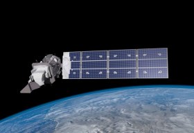
SmartSat partners, participants, students and staff are invited to come together to share their research outcomes and network with industry colleagues at the SmartSat CRC Conference 2023.
The SmartSat CRC is a consortium of universities and other research organisations, partnered with industry that has been funded by the Australian Government to develop know-how and technologies in advanced telecommunications and IoT connectivity, intelligent satellite systems and Earth observation next generation data services.
Landsat image courtesy NASA/GSFC

Featuring a spotlight on crowd-sourced bathymetry, the Map the Gaps Symposium 2023 will bring people together to learn, share and contribute to ocean discovery.
Held on behalf of GEBCO, this event draws global experts in ocean technology, science and policy to discuss deep and coastal ocean exploration, offshore surveying technology, policy, diversity, equity and inclusion, the Nippon Foundation-GEBCO Seabed 2030 project and GEBCO alumni activities.
Participation is open to all, including industry professionals, explorers, authors, students, researchers, government representatives and emerging technologists. Participants can attend in person or online.

The 2024 edition of the International Conference on Geographical Information Systems Theory, Applications and Management (GISTAM 2024) aims to create a meeting point of researchers and practitioners that address new challenges in geo-spatial data sensing, observation, representation, processing, visualization, sharing and managing, in all aspects concerning both ICT as well as management information systems and knowledge-based systems.
The conference welcomes original papers of either practical or theoretical nature, presenting research or applications, of specialised or interdisciplinary nature, addressing any aspect of geographic information systems and technologies, such as:
- Data acquisition and processing
- Remote sensing
- Interaction with spatial-temporal information
- Spatial data mining
- Managing spatial data
- Modelling, representation and visualisation
- GIS and climate change
- Domain applications

The complexities of understanding and forecasting evolutionary processes necessitate geographic modelling and simulation, which have emerged as potent tools for addressing critical issues such as climate change and sustainable resource use. But there is a pressing need for an open geographical modelling and simulation framework. Such a framework would serve as a catalyst, attracting more scholars and encouraging their collective efforts to address geographic challenges.
This workshop is designed to explore pertinent theories, approaches and potential applications, while fostering communication among experts from diverse domains. Its primary objectives include stimulating extensive discussions regarding the potential directions of the field and promoting further research, thus paving the way for a promising future in collaborative geographic modelling and simulation.
Organisers:
- School of Geography Science, Nanjing Normal University, China
- Key Laboratory of Virtual Geographic Environment (Ministry of Education of PRC), Nanjing Normal University, China
- International Geographical Union – Modeling Geographical Systems Commission
Co-organisers:
- International Environmental Modelling and Software Society
- The International Association of Chinese Professionals in Geographic Information Sciences
- Geographic Model and Geographic Information Analysis Commission, The Geographical Society of China
- Working Group on Education and Capability Building for Digital Earth, International Society for Digital Earth
- Jiangsu Center for Collaborative Innovation in Geographical Information Resource Development and Application, China
- National Earth System Science Data Center – Yangtze River Delta Subcenter
- School of Environment, Nanjing Normal University
Important dates:
- Abstracts due: 20 August 2024
- Early-bird registration ends: 31 August 2024

GISTAM 2025, the 11th International Conference on Geographical Information Systems Theory, Applications and Management will be a meeting point of researchers and practitioners that address new challenges in geospatial data sensing, observation, representation, processing, visualisation, sharing and management.
This includes all aspects of information communication and technologies as well as management information systems and knowledge-based systems.
The conference will present original contributions of either practical or theoretical nature, including research and applications of specialised or interdisciplinary natures, addressing different aspects of geographic information systems and technologies.
Topics to be covered include:
- Data acquisition and processing
- Remote sensing
- Interaction with spatial-temporal information
- Spatial data mining
- Managing spatial data
- Modelling, representation and visualisation
- GIS and climate change
- Domain applications
Deadlines:
- Regular Paper Submission: 13 December 2024
- Abstracts Track Submission: 30 January 2025


