Are you a young surveyor and always wondered what the digital frontier of the profession looked like? Are you mid career but developed foundation skills but have not yet ventured into the digital data part of the discipline? Are you a seasoned professional who loves to see what amazing things you can do with the tools and technologies of the 21st century?
If you answered yes to any of those questions then this is a webinar you won’t want to miss!
Michael Finlay is a Geospatial Engineer who specialises in 3D laser scanning and point cloud technologies. He is an early career professional who has been working at Jacobs for 8 years and is passionate about all things 3D laser scanning, especially mobile laser scanning (MLS). Michael is a trail blazer in developing the digital data team and discipline at Jacobs as not only a real value add, efficiency but product and service enricher for the surveying team. He gets involved with the planning, scanning, processing, adjusting, classifying, extracting, automation, analysis, visualisation and supports the interfaces of surveying and digital engineering and GIS environments for stakeholders from a broad variety of disciplines.
Check out Michael’s profile to see some of the amazing projects he has been involved in and how he champions this modern digital space for surveying and geospatial engineers.
Registration
By registering below, you receive access to the watch the webinar live OR if you can’t watch it live, you receive the link to the recording 24 hours after the event date. You can then watch the recording at your leisure.
CPD
This event is worth one SSSI CPD Point. BOSSI points to be confirmed.
Note, only the individual registered for the event is entitled to receive the associated CPD points.
Contact
Katie Le Miere, National Events Manager
katie.lemiere@sssi.org.au

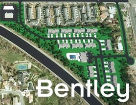
Join Bentley Systems at the launch of what it says is the industry’s most complete Survey and Site Design Solution ever offered to the ANZ market.
As technology advances and industry expectations increase, your software needs to keep pace with this ever-changing environment. In short, your software needs to deliver on today’s requirements and be ready for tomorrow’s challengers.
If you work in road design, site surveying, site development and related fields, this webinar is for you.
Throughout the launch, Bentley Systems will demonstrate traditional survey data capture capabilities, coupled with the latest mass data collection survey methods, including Total Station techniques, Point Cloud techniques and Digital Photogrammetry techniques.
Leveraging the above survey results, the launch will continue through a typical site design workflow, incorporating aspects such as:
- Terrain creation and analysis
- Urban road widening design
- Carpark and recreational area design
- Drainage and Utility design and analysis
- Plan production and digital model delivery
- Model visualisation
Air Inspect Australia will also be joining the webinar to share their insights and learnings of their project.
If you or your company perform any of the above-mentioned workflows, then this is one webinar you should not miss.

The 15th International Conference on Spatial Information Theory, COSIT 2022, will be held in Kobe, Japan, 5 to 9 September, 2022. Established in 1993, the Conference on Spatial Information Theory (COSIT) is a biennial international conference series concerned with theoretical aspects of space and spatial information, aimed at advancing geographic information science and its emerging research frontiers.
The conference offers three (refereed) submission tracks with double-blind reviews: vision papers, full papers, and short papers. Embedded in the conference will also be an on-site mentoring program for doctoral students.
Contributions can cover a broad set of conference-relevant themes such as (but not limited to):
- activity-based models of spatial knowledge
- cognitive aspects of geographic information
- cognitive-behavioural geography, naive geography
- data-driven spatial information theory
- geo-ethics and geo-privacy
- events and processes in geographic space and time
- geographic information visualisation and geovisual analytics
- knowledge representation for space and time
- navigation and wayfinding of sentient beings and robots
- ontology of space and time
- place
- quality and interoperability of geographic information
- social and cultural organisation of space
- spatial and temporal language
- spatial aspects of social networks
- spatial decision support, impact of model design
- spatial (digital) humanities
- theory-driven spatial machine learning, artificial intelligence of space
- theories on volunteered geographic information
- theory and practice of spatial and temporal reasoning
- user interfaces, virtual spaces and collaborative spaces

The Indo-Pacific Space & Earth Conference will delve into technologies that can be applied both on Earth and in space — from AI and robotics to remote operations. All industries from mining, oil and gas, agriculture, medicine and more can benefit from investing resources into these technologies.
Supported by key industry players and the government, the goal of the conference is to bring everyone together to discover new innovations and capabilities to create future opportunities.
Image credit: ©stock.adobe.com/au/MclittleStock

GeoBuiz Summit is an annual international conference focused on the geospatial industry, which encompasses a range of technologies and applications related to mapping, location-based services, and spatial data analysis.
The summit brings together industry leaders, government representatives, experts, and innovators to discuss the latest trends and innovations in geospatial technology and applications.
The conference covers a range of topics, including geospatial infrastructure, mapping and surveying, satellite imagery and remote sensing, location-based services, smart cities and urban planning, and much more. The GeoBuiz Summit aims to promote collaboration and knowledge-sharing within the geospatial industry and to showcase the latest developments in this exciting and rapidly evolving field.

The Geospatial Council of Australia’s Spatial Information Day will be an immersive journey into the dynamic world of geospatial data and technology.
Delegates will have the opportunity to engage with industry leaders, renowned experts and fellow enthusiasts, while delving into the latest advancements reshaping the understanding of space and place. On the agenda will be innovative solutions driving progress across sectors such as urban planning, environment management and disaster response.
The event will be followed in the evening by the 2024 SA Geospatial Excellence Awards Dinner, the industry’s premier platform to celebrate the achievements of top geospatial organisations and individuals in the state.


