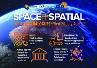
During 2020 an expert group drafted the SPACE+SPATIAL Industry Growth Roadmap 2030 – a national snapshot for Australian professionals to better understand the bold new future that’s rapidly approaching and what it means for them, their careers, their organisations and all of Australia.
The National Steering Committee is seeking feedback on the Roadmap from spatial professionals of all levels across the country. There are a number of ways to get involved, one of which is to participate in this SSSI and SIBA|GITA SPACE+SPATIAL Roadmap Online Session.
You will hear about the key plans, activities and issues and have the opportunity to have a meaningful discussion with colleagues about your thoughts on the Roadmap Consultation Paper and the topic in general.
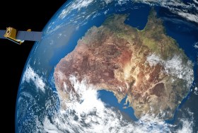
The Space & Geospatial Collaborative Workshop will be jointly hosted by the Andy Thomas Space Foundation and the Surveying and Spatial Sciences Institute in Adelaide the day following the 12th Australian Space Forum and the day before Spatial Information Day.
This inter-disciplinary workshop will provide a unique opportunity for professionals from both space and spatial sectors to:
- Learn about Australia’s renewed commitment to space technology development
- Get updates on the requirements and capabilities of the modern spatial information industry using applications such as PNT (positioning, navigation and timing), EO (Earth Observation) and telecommunications
- Connect and discuss the increasing synergy and collaborative opportunities between the two sectors.
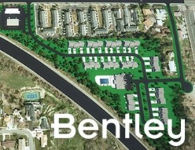
Join Bentley Systems at the launch of what it says is the industry’s most complete Survey and Site Design Solution ever offered to the ANZ market.
As technology advances and industry expectations increase, your software needs to keep pace with this ever-changing environment. In short, your software needs to deliver on today’s requirements and be ready for tomorrow’s challengers.
If you work in road design, site surveying, site development and related fields, this webinar is for you.
Throughout the launch, Bentley Systems will demonstrate traditional survey data capture capabilities, coupled with the latest mass data collection survey methods, including Total Station techniques, Point Cloud techniques and Digital Photogrammetry techniques.
Leveraging the above survey results, the launch will continue through a typical site design workflow, incorporating aspects such as:
- Terrain creation and analysis
- Urban road widening design
- Carpark and recreational area design
- Drainage and Utility design and analysis
- Plan production and digital model delivery
- Model visualisation
Air Inspect Australia will also be joining the webinar to share their insights and learnings of their project.
If you or your company perform any of the above-mentioned workflows, then this is one webinar you should not miss.

The presenters for this topical webinar will be Dr Craig Roberts, Senior Lecturer in Surveying/GPS/Geodesy at UNSW and Wayne Patterson Director, Spatial Operations at the NSW Department of Customer Service.
Roberts will give a short update on the revision of the Australian Standard, AS_5488 Classification of subsurface utility information in the context of datum modernisation, low-cost multi-GNSS and recent advances in positioning infrastructure in Australia.
Data storage, data distribution and security are identified as challenges suggesting a reimagined data governance will be needed. Could a spatial digital twin assist? What is a spatial digital twin? Is it a BIM? Where does it come from? What is an open data policy? Who can use it? Can I use it? Which datum? How accurate is the data?
Rather than just another PowerPoint webinar, Roberts will interview Patterson in a free-flowing format. Attendees will be invited to ask their own questions live in the chat as the conversation evolves.
This webinar is targeted at surveyors, geospatial users, students and the wider spatial community.
The Andy Thomas Space Foundation is looking forward to welcoming a global audience to the 14th Australian Space Forum, which will be held on Tuesday, 25 October 2022 at the Adelaide Convention Centre in South Australia.
Supported by the Australian Space Agency, the South Australian Space Industry Centre and SmartSat CRC, the Forum will provide an opportunity to stimulate ideas, share information about emerging technologies and network with influential space sector leaders and the broader community.
Participants can attend in-person, or virtually through the event’s global interactive platform.
Forum sessions will include international panels covering highly pertinent topics that shape our industry:
Earth Observation: The National Space Mission for Earth Observation is a major investment that will expand Australia’s capability in designing, manufacturing and operating space- and ground-based systems.
Optical Communications: A quantum leap in Australia’s secure and high-bandwidth communications to connect the world and beyond.
Foundation Services Rover: Exploring remote operations and autonomous systems by building on Australian expertise in the resources and mining sectors for the collection of lunar soil (regolith).
Each year, the Locate conference attracts hundreds of national and international delegates from within and outside the spatial and surveying industry.
As Australia’s premier spatial and surveying conference, Locate provides guests with a unique opportunity to learn about the latest trends and applications in geospatial technologies.
Are you passionate about our industry and want to get involved? Maybe you have an idea for a local tour, or a project site visit or even have another event that can run in conjunction with Locate. This is your opportunity to help shape the 2023 event — no idea is too big or too small. Reach out to the organisers via info@locateconference.com or +61 2 4319 8519.
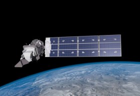
SmartSat partners, participants, students and staff are invited to come together to share their research outcomes and network with industry colleagues at the SmartSat CRC Conference 2023.
The SmartSat CRC is a consortium of universities and other research organisations, partnered with industry that has been funded by the Australian Government to develop know-how and technologies in advanced telecommunications and IoT connectivity, intelligent satellite systems and Earth observation next generation data services.
Landsat image courtesy NASA/GSFC

The Geospatial Council of Australia’s Spatial Information Day will be an immersive journey into the dynamic world of geospatial data and technology.
Delegates will have the opportunity to engage with industry leaders, renowned experts and fellow enthusiasts, while delving into the latest advancements reshaping the understanding of space and place. On the agenda will be innovative solutions driving progress across sectors such as urban planning, environment management and disaster response.
The event will be followed in the evening by the 2024 SA Geospatial Excellence Awards Dinner, the industry’s premier platform to celebrate the achievements of top geospatial organisations and individuals in the state.


