SSSI in conjunction with the Hunter Environmental Institute will present this webinar with three pre-eminent speakers:
Amy Steiger (Cardno)
Title: RPAS and thermal cameras for wildlife detection post-bushfire and coastal monitoring
Details: Amy has promoted the use of Remotely Piloted Aircraft Systems (RPAS) gaining experience with remote data capture to cover a range of coastal, environmental and land development applications.
RPAS thermal inspection capability was deployed this summer in wildlife detection post-bushfires.
Amy has also done volumetric surveys of beaches and flown isolated coastal cliff faces in NSW to capture high-resolution photography and derived photogrammetric models to identify geotechnical hazards and contribute to coastal monitoring.
Charity Mundava (WaterNSW)
Title: Remote Sensing in Water Management
Details: Charity will discuss the use of GIS and remote sensing to support water catchment management, feasibility and environmental studies for critical water infrastructure across the state and to support ongoing research into and management of river catchments. Charity will touch on the significance and spatial support for this in the recent NSW bushfires coordinating reservoir availability (in drought) and access for helicopter water drops and supporting bushfire fighting efforts.
Associate Professor In-Young Yeo (University of Newcastle)
Title: Remote sensing and GIS applications for water resources management
Details: Dr Yeo will explain how remote sensing can be used as a technique for assessing soil moisture using multi-source data fusion approaches, vegetation monitoring and water requirement with remote sensing and water balance approach.
She will explain the impacts of conservation management practices in agricultural catchments assessed using catchment model and remote sensing/GIS drawing on examples from Australian and American case studies
CPD Points
BOSSI CPD is 1 SP for this webinar.
Cost
As per details as follows
Contact
rom.nsw@sssi.org.au

Global Space and Technology Convention (GSTC) is Asia’s Premier Space & Technology event, bringing you the latest technology news, what’s hot in the satellite scene and space technology updates. Over 10 years in the making, GSTC has taken up a crucial role in highlighting how space technology and satellite communications will shape our lives here in Asia. From learning how satellite communication and data can transform urban cities, to its applications in maritime surveillance, security and IoT, GSTC is the go-to platform for your space and satellite business, to connect with the rapidly evolving space industry in Asia.

The ROTORTECH 2022 Helicopter and Unmanned Flight Exposition is the premier industry event for the Helicopter/Rotary Wing and RPAS/UAV/eVTOL community in Australia, New Zealand and the Indo-Asia-Pacific region.
The event provides a vital interface between industry, regulators and government, including:
- Operations and safety presentations
- Industry conferences
- Industry exposition showcasing the products and services of helicopter and unmanned flight related companies
ROTORTECH 2022 will host conferences by the Australian Helicopter Industry Association (AHIA) and Australian Association for Uncrewed Systems (AAUS) and feature presentations by key rotary and unmanned systems industry experts from Australia and the Indo-Asia-Pacific region.

Hosted by Eric Andelin CP, Senior Workflow Specialist with guest speaker Michael O’Sullivan, VP Sales, SimActive Inc.
It is often challenging for new entrants into the aerial imagery and mapping service profession to determine cost savings when it comes to their processing software solution. Smaller sensors, altitude restrictions, line of sight requirements and overall flight duration create unique challenges for drone operators. Medium and large format sensors acquire much larger areas, but require a much larger investment, or the ability to subcontract out the acquisition. Mapping expenses tend to increase as projects become larger. And using the wrong image processing software can exacerbate this, leading to narrowing project profits. This webinar will show how a higher-end software such as SimActive’s Correlator3D™ can reduce overall project costs. REGISTER HERE.
Specifically, attendees will learn about the following:
- Common challenges and impact on costs
- Cost variations as projects increase in size
- Workflows in Correlator3D to minimize man-hours
- Accelerating timelines with distributed processing

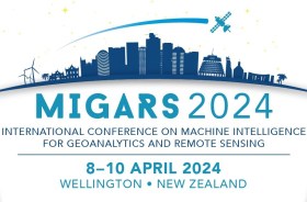
The International Association of the IEEE-Geoscience and Remote Sensing Society (GRSS), the IEEE-Computational Intelligence Society (CIS) and the local organising committee invite geospatial and computing professionals to attend the International Conference on Machine Intelligence for GeoAnalytics and Remote Sensing (MIGARS) to be held in Wellington, Aotearoa New Zealand in April 2024.
MIGARS aims to explore the interface of machine intelligence approaches with geosciences, spatial analytics, and remote sensing. With the tremendous developments in remote sensing technology, data acquisitions and sensing platforms, digital data have grown leaps and bounds to stream and are too big by volume, variety, and veracity. The challenge is handling, processing, and automating geo-data from various sources, such as multi-platform remote sensors and IoT devices, informing decision-making and monitoring our planet.
The conference will focus on connecting researchers from various disciplines, including computation/artificial intelligence, engineering, remote sensing, hydrology, agriculture and geosciences, and look for the potential use of intelligent computational approaches for geo-data-based applications and for serving society at large.

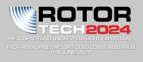
The ROTORTECH Helicopter and Uncrewed Flight Exposition is the premier industry event for the Helicopter/Rotary Wing and RPAS/UAV/eVTOL community in Australia, New Zealand and the Indo-Asia-Pacific region.
Held by AMDA Foundation with input from major industry supporter the Australian Helicopter Industry Association, ROTORTECH 2024 will provide a vital interface between industry, regulators and government, including:
- Operations and safety presentations
- Industry conferences
- Manufacturers technical workshops
- Industry exposition showcasing the products and services of helicopter and uncrewed flight related companies
ROTORTECH 2024 will host conferences by the AHIA and Australian Association for Uncrewed Systems (AAUS) and feature presentations by key rotary and uncrewed flight industry experts from Australia and the Indo-Asia-Pacific region.


