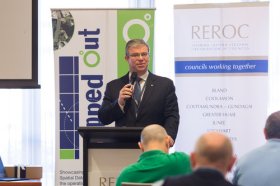
The latest in spatial data applications will be showcased at this year’s Mapped Out Conference to be held at the Rules Club in Wagga Wagga on Wednesday 2 & Thursday 3 March 2022.
Mapped Out will highlight the diversity of applications for spatial data, geographic information systems and their supporting technologies. Guest speakers with local and national experience will be showcasing the use of spatial data to enhance the operation and delivery of government services.
The Conference is a great opportunity for people working in regional NSW in both local government and the private sector to keep abreast of the latest technology and geographical information systems that can be utilised in their day to day work.

The Australian Association for Unmanned Systems’ ‘RPAS in Australian Skies 2022’ conference aims to continue discussion on the safe integration of RPAS into Australian airspace. It is supported by key government and industry participants and has established itself as a landmark event in the Australian RPAS calendar.
The 2022 themes will cover:
- Policy and Regulatory updates from the Department of Infrastructure, Transport, Regional Development and Communications, CASA, AirServices Australia and the Australian Defence Force relating to the use of emerging aviation technology in Australia.
- UAS Traffic Management (UTM), low level airspace, integrated airspace systems challenges and opportunities.
- Industry challenges and perspectives
- Continuing development of a professional and safe industry.
- ATSB RPAS data and trends
- Emerging technology and innovative solutions enabling integration or RPAS into Australian airspace.
- Future infrastructure requirements to enable drone delivery and advanced air mobility (AAM).
- Emerging RPAS and AAM applications – benefits, viability and social acceptance.
The conference will be a hybrid event incorporating face to face (live) and online (virtual) choices for participants. It will also include the AAUS Gala Dinner featuring the AAUS Industry Awards.

On behalf of the Locate Australia Conferences it is our pleasure to invite you to join us at Locate22, 24 – 26 May in Canberra, Australian Capital Territory.
Locate22 returns to the Nation’s Capital in the traditional format of a live event at the National Convention Centre Canberra (NCCC). With the ability to be COVID safe, within a socially distanced environment, the NCCC is the perfect venue for Australia’s premier spatial and surveying conference. Canberra brings an incomparable setting with iconic national attractions surrounding Lake Burley Griffin and the Parliamentary Triangle.
This year Locate22 will incorporate dedicated streams into the format of the conference. This will enable focused discussion from across industry sectors on how location technologies and practices are being used, highlighting the fundamental role they play in shaping Australia’s future.
Industry, government, non-profit and academics are demanding new opportunities for innovation, efficiency and improved responsiveness, particularly in location-based information. In the past year alone, we’ve seen how location information can provide societal, environmental and economic benefits to our communities. Recent national emergencies such as bushfires, drought, floods and COVID-19 all have long-term effects on our cities, towns, land, environment and people. These national, place-based challenges require collaborative solutions that must be data-driven, provide insightful analysis, and be easy for anyone, anywhere to use.
Location in Action is about how we learn, share and connect as a community and with end users to drive deeper insights and aid better decision-making powered through location data, science and technologies.
Come and join us in Canberra where you will have an opportunity to network with national and international colleagues, have direct access to industry and subject matter experts, see the newest technology, and be introduced to the newest ideas in the spatial and surveying sector.
ALISON ROSE
CONVENOR
LOCATE 22

The 15th International Conference on Spatial Information Theory, COSIT 2022, will be held in Kobe, Japan, 5 to 9 September, 2022. Established in 1993, the Conference on Spatial Information Theory (COSIT) is a biennial international conference series concerned with theoretical aspects of space and spatial information, aimed at advancing geographic information science and its emerging research frontiers.
The conference offers three (refereed) submission tracks with double-blind reviews: vision papers, full papers, and short papers. Embedded in the conference will also be an on-site mentoring program for doctoral students.
Contributions can cover a broad set of conference-relevant themes such as (but not limited to):
- activity-based models of spatial knowledge
- cognitive aspects of geographic information
- cognitive-behavioural geography, naive geography
- data-driven spatial information theory
- geo-ethics and geo-privacy
- events and processes in geographic space and time
- geographic information visualisation and geovisual analytics
- knowledge representation for space and time
- navigation and wayfinding of sentient beings and robots
- ontology of space and time
- place
- quality and interoperability of geographic information
- social and cultural organisation of space
- spatial and temporal language
- spatial aspects of social networks
- spatial decision support, impact of model design
- spatial (digital) humanities
- theory-driven spatial machine learning, artificial intelligence of space
- theories on volunteered geographic information
- theory and practice of spatial and temporal reasoning
- user interfaces, virtual spaces and collaborative spaces

The International Cartographic Association (ICA) invites you to share your research, practice and experiences in cartography and GIScience at the 31st International Cartographic Conference (ICC 2023), to be held from 13 to 18 August 2023 in Cape Town, South Africa.
The conference theme will be ‘Smart Cartography for Sustainable Development’.
Important dates:
- 5 December 2022 – Submission of full papers closes
- 12 December 2022 – Submission of abstracts closes
- February 2023 – Conference registration opens
- 28 February 2023 – Notification of acceptance
- 8 May 2023 – Submission of revised abstracts and papers
- 15 May 2023 – Early Bird registration closes
- 15 May 2023 – Registration deadline for presenters of abstracts, papers and posters

The Local Government Spatial Reference Group (LGSRG) will be holding a webinar on Monday, 4 September, to introduce a series of hands-on workshops it will be holding across Victoria during September 2023.
The webinar will cover the topic of Best Practice Geospatial Intelligence for Climate Impact, and will address important topics on climate impact, community safety and how geospatial intelligence can contribute to better outcomes for local governments.
The LGSRG was formed in 2003 to address the need for a sector wide group representing the strategic interests of the Victorian Local Government sector with respect to spatial information. The LGSRG has been active throughout the COVID pandemic to keep the local government geospatial community connected and engaged via the annual Spatial Capability Workshop series which have grown year on year, and is now diversifying with a quarterly Spatial Hour webinar to share stories of success within the local government geospatial sector.
Image credit: ©stock.adobe.com/au/yutthana

The 2024 edition of the International Conference on Geographical Information Systems Theory, Applications and Management (GISTAM 2024) aims to create a meeting point of researchers and practitioners that address new challenges in geo-spatial data sensing, observation, representation, processing, visualization, sharing and managing, in all aspects concerning both ICT as well as management information systems and knowledge-based systems.
The conference welcomes original papers of either practical or theoretical nature, presenting research or applications, of specialised or interdisciplinary nature, addressing any aspect of geographic information systems and technologies, such as:
- Data acquisition and processing
- Remote sensing
- Interaction with spatial-temporal information
- Spatial data mining
- Managing spatial data
- Modelling, representation and visualisation
- GIS and climate change
- Domain applications

The 4th International Symposium on Applied Geoinformatics (ISAG2024), which will take place at the Wroclaw University of Science and Technology, Wroclaw, Poland, on 9 and 10 May 2024. ISAG2024 is jointly organised by the Department of Geomatics Engineering, Yildiz Technical University, Istanbul, Türkiye, Wroclaw University of Science and Technology, Wroclaw, Poland and Technical University of Crete, Chania, Crete, Greece.
The aim of the 4th ISAG is to bring scientists, engineers and industry researchers together to exchange and share their experiences and research results and discuss the practical challenges encountered and the solutions adopted in geoinformatics.
Topics to be covered include recent advances in AI, satellite imagery, advanced remote sensing, photogrammetry, image processing, global navigation satellite systems, height systems, terrestrial laser scanning, GIS, smart cities and land management.

The 9th International Conference on Cartography and GIS will take place in Nessebar, Bulgaria from 16 to 21 June 2024. The ICCGIS is a biannual conference that began in 2006 and has been held every two years since (except for 2020). In total, the Conference has attracted attendees from more than 60 countries and has published more than 700 scientific papers in its proceedings.
The aim of the conference is to collect knowledge and share experiences about the latest achievements in the field of cartography and GIS. Multiple parallel events will take place during the conference, including annual meetings of ICA commissions and a special ISDE plenary session. There will also be a Seminar on Disaster Risk Reduction – Solutions and Innovations.

The 35th International Geographical Congress (IGC), to be held in Dublin, Ireland in August 2024, will provide an opportunity to share the best of global geographic research, discuss common challenges and opportunities and connect with colleagues from across the world.
The event is being organised by the International Geographical Union and the Geographical Society of Ireland.
The IGC 2024 will continue the tradition of previous congresses in recognising that our world faces many common natural and societal challenges that can only be dealt with through global action, understanding and sharing. In this respect, geography as a discipline, its skills, attributes and the geographic mindset has much to offer other disciplines, policymakers, officials, politicians and communities.
The theme of the congress is ‘Celebrating a World of Difference,’ and we are strongly focused through our academic and fieldwork program on:
- supporting intercultural awareness and understanding;
- promoting intellectual diversity as a strength;
- bringing geographic research and thinking beyond the congress walls; and
- grappling with the complex interconnections between people, place and the natural world.


