Although it has been almost 50 years since there have been a requirement for field information to be lodged, Sec 71 (e) of the Cadastral Rules for Survey 2021 requires the submission of “all relevant field information, in a form that ensures permanent usability”.
While surveyors have been retaining field information electronically, LINZ has found that in many cases the data has been inadequate or needs specific software, or there can be difficulty identifying raw measurements after processing or to relate them to the dataset.
This seminar will share insights from knowledgeable suppliers and practitioners to assist surveyors develop systems and processes to comply with the Rules and to present electronic field data in a clearly readable way.
Participants can attend in person or online.

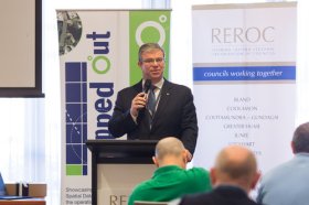
The latest in spatial data applications will be showcased at this year’s Mapped Out Conference to be held at the Rules Club in Wagga Wagga on Wednesday 2 & Thursday 3 March 2022.
Mapped Out will highlight the diversity of applications for spatial data, geographic information systems and their supporting technologies. Guest speakers with local and national experience will be showcasing the use of spatial data to enhance the operation and delivery of government services.
The Conference is a great opportunity for people working in regional NSW in both local government and the private sector to keep abreast of the latest technology and geographical information systems that can be utilised in their day to day work.

Survey and Spatial NZ’s 2022 conference will be held from 1 to 3 August at the Novotel Lakeside, Rotorua. The conference is the biggest continuing professional development event of the year for NZ surveying and spatial professionals. It invites sharing of knowledge amongst peers, bringing together networking opportunities for all delegates and is an essential event for professional development and connectivity within the sector.
The choice of Rotorua as the location is apt, given the conference theme of ‘Turning up the Heat’. The organisers aim to stimulate discussion regarding challenges in regional areas, which include climate change and developments outside of Auckland.

The World of Drones and Robotics Congress New Zealand (WoDaRC NZ) is shaping up as an unmissable event for anyone involved in robotics, drones, AI, AgTech and data-led innovation. WoDaRC is business-led, technology based and will create opportunities for collaboration and growth across the technology ecosystem.
Topics to be covered include:
- Regional capability and strategy
- Humanitarian engineering and disaster response
- Environmental science and agricultural technology
- The new frontiers: oceans, mountains, and space
- Movies, media, community, and social empowerment
- Education

The International Cartographic Association (ICA) invites you to share your research, practice and experiences in cartography and GIScience at the 31st International Cartographic Conference (ICC 2023), to be held from 13 to 18 August 2023 in Cape Town, South Africa.
The conference theme will be ‘Smart Cartography for Sustainable Development’.
Important dates:
- 5 December 2022 – Submission of full papers closes
- 12 December 2022 – Submission of abstracts closes
- February 2023 – Conference registration opens
- 28 February 2023 – Notification of acceptance
- 8 May 2023 – Submission of revised abstracts and papers
- 15 May 2023 – Early Bird registration closes
- 15 May 2023 – Registration deadline for presenters of abstracts, papers and posters

Planning is underway for the S+SNZ 2023 Annual Conference which will be held at Otago University in Dunedin from 30 August through to 1 September 2023.
The S+SNZ conference is the biggest continuing professional development event of the year for NZ surveying and spatial professionals. It invites sharing of knowledge amongst peers, bringing together networking opportunities for all delegates and is an essential event for professional development and connectivity within the sector.

The Local Government Spatial Reference Group (LGSRG) will be holding a webinar on Monday, 4 September, to introduce a series of hands-on workshops it will be holding across Victoria during September 2023.
The webinar will cover the topic of Best Practice Geospatial Intelligence for Climate Impact, and will address important topics on climate impact, community safety and how geospatial intelligence can contribute to better outcomes for local governments.
The LGSRG was formed in 2003 to address the need for a sector wide group representing the strategic interests of the Victorian Local Government sector with respect to spatial information. The LGSRG has been active throughout the COVID pandemic to keep the local government geospatial community connected and engaged via the annual Spatial Capability Workshop series which have grown year on year, and is now diversifying with a quarterly Spatial Hour webinar to share stories of success within the local government geospatial sector.
Image credit: ©stock.adobe.com/au/yutthana


