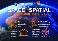
SSSI in conjunction with the Hunter Environmental Institute will present this webinar with three pre-eminent speakers:
Amy Steiger (Cardno)
Title: RPAS and thermal cameras for wildlife detection post-bushfire and coastal monitoring
Details: Amy has promoted the use of Remotely Piloted Aircraft Systems (RPAS) gaining experience with remote data capture to cover a range of coastal, environmental and land development applications.
RPAS thermal inspection capability was deployed this summer in wildlife detection post-bushfires.
Amy has also done volumetric surveys of beaches and flown isolated coastal cliff faces in NSW to capture high-resolution photography and derived photogrammetric models to identify geotechnical hazards and contribute to coastal monitoring.
Charity Mundava (WaterNSW)
Title: Remote Sensing in Water Management
Details: Charity will discuss the use of GIS and remote sensing to support water catchment management, feasibility and environmental studies for critical water infrastructure across the state and to support ongoing research into and management of river catchments. Charity will touch on the significance and spatial support for this in the recent NSW bushfires coordinating reservoir availability (in drought) and access for helicopter water drops and supporting bushfire fighting efforts.
Associate Professor In-Young Yeo (University of Newcastle)
Title: Remote sensing and GIS applications for water resources management
Details: Dr Yeo will explain how remote sensing can be used as a technique for assessing soil moisture using multi-source data fusion approaches, vegetation monitoring and water requirement with remote sensing and water balance approach.
She will explain the impacts of conservation management practices in agricultural catchments assessed using catchment model and remote sensing/GIS drawing on examples from Australian and American case studies
CPD Points
BOSSI CPD is 1 SP for this webinar.
Cost
As per details as follows
Contact
rom.nsw@sssi.org.au

During 2020 an expert group drafted the SPACE+SPATIAL Industry Growth Roadmap 2030 – a national snapshot for Australian professionals to better understand the bold new future that’s rapidly approaching and what it means for them, their careers, their organisations and all of Australia.
The National Steering Committee is seeking feedback on the Roadmap from spatial professionals of all levels across the country. There are a number of ways to get involved, one of which is to participate in this SSSI and SIBA|GITA SPACE+SPATIAL Roadmap Online Session.
You will hear about the key plans, activities and issues and have the opportunity to have a meaningful discussion with colleagues about your thoughts on the Roadmap Consultation Paper and the topic in general.

This event defines and showcases the global commercial UAV industry, with a special focus on solutions in the Americas region and a glimpse into the world of urban air mobility. It showed consistent growth for 5 straight years, with 3,100+ live attendees in 2019 – up 32% – and a record 200 exhibiting companies.
It moves to much larger space right on the Las Vegas Strip for 2021 and adds a collocated Urban Air Mobility Summit produced by RAI Amsterdam. Strictly commercial by choice, it draws the power buyers and global influencers and sets the pace for the industry, with innovative formats, cutting-edge content, and unmatched excitement on the expo floor.
It is a must-attend event and will convene delegates and exhibitors from 6 continents. www.expouav.com Commercial UAV Expo Americas is produced by Diversified Communications’ technology portfolio which also includes Commercial UAV Expo Europe; Commercial UAV News; Geo Week comprised of the International Lidar Mapping Forum, SPAR 3D Expo & Conference, AEC Next Technology Expo & Conference; Geo Week ENewsletter, SPAR 3D ENewsletter, AEC ENewsletter.
For more information about exhibiting at Commercial UAV Expo, visit www.expouav.com/exhibition/ or contact Katherine Dow, Sales Manager, at kdow@divcom.com or +1.207-842-5497. For attending information, visit www.expouav.com or email info@expouav.com.

The Geospatial Council of Australia invites industry members to participate in the special South Australian Geospatial Excellence Awards reception on Friday, 27 October 2023, in the Riverbank Rooms at the Adelaide Convention Centre.
With no Spatial Information Day this year due to Locate23 being held in Adelaide, this event will be held to announce the 2023 South Australia award winners, whilst also showcasing some of last year’s incredible winning projects.
The evening will be an opportunity for networking with colleagues old and new, and for celebration of the local geospatial industry.
Image credit: ©stock.adobe.com/au/andy_di

The IGNSS Association’s biennial international GNSS conference will return to UNSW Sydney from 7 to 9 February, 2024, where it will celebrate the first half-century of GNSS and look ahead to the next 50 years.
IGNSS 2024 will bring together experts, policy makers and emerging leaders from across the globe to examine the latest advances, present cutting edge research and discuss policy, market development and infrastructure.
The conference will also showcase Australia and New Zealand’s Southern Positioning Augmentation Network (SouthPAN), along with developments by other countries across the Asia-Pacific.
Topics to be covered at the conference will include:
- Autonomy on land, air, sea and in space
- Aviation and avionics
- Cooperative Intelligent Transport Systems
- Machine guidance applications in agriculture, construction and mining
- Maritime applications
- Uncrewed aerial systems
- Space applications of PNT in Earth orbit and for lunar and Martian exploration
- Positioning infrastructure
- GNSS vulnerability, resilience and risk
- Interference detection and mitigation
- Policies and standards
- SBAS and other augmentations
- Datums and geodesy
- National and international GNSS developments
- Emerging application areas for GNSS
- Key industries and their reliance on GNSS
- The multi-GNSS era
- Cyber security in PNT applications and infrastructure
- Alternative PNT
- State of the art in PNT algorithms and software development
- GNSS aiding and sensor fusion
- Positioning in GNSS denied environments
- Development of GNSS receiver hardware and firmware
- Precise position using smartphones
The organisers are encouraging early career researchers and industry representatives to present their work. The abstract submission process will open soon — keep an eye on the IGNSS website for announcements.
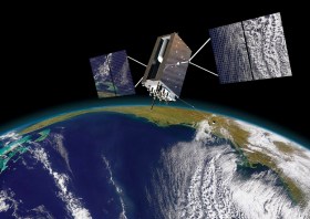
Image courtesy Lockheed-Martin

The not-to-be-missed Geospatial Council of Australia (GCA) South Australia Cadastral Workshop, to be held in Adelaide on 16 March, will bring together professionals in the field of land surveying and provide an opportunity for them to expand their knowledge of the complexities of cadastral surveying.
This workshop offers a unique opportunity for professionals in the field of land surveying to gather and expand their knowledge in the complexities of cadastral surveying. Participants will hear expert-led discussions into topics ranging from advanced surveying techniques to legal frameworks governing land boundaries, and gain invaluable insights to enhance their expertise and address the challenges of modern cadastral surveying practices.
- Members: $90 (incl. GST)
- Non-members: $135 (incl. GST)
- Registered survey graduates and students: $45 (incl. GST)


