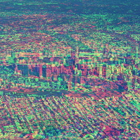
The Future of Place Summit aims to be a day filled with critical discussion, knowledge sharing and networking around the intersection of people, place technology and data.
The event will focus on four themes:
- Designing for digital lifestyles — A new human-centred planning approach
- From precinct plans to development reality — The evolving digital and data DNA of urban growth
- Data-inspired discussions — Tapping into the real voice of the community
- Streets reimagined — The digital backbone for better experiences
Delegates can take part in person or via Zoom.
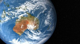
Supported by the Australian Space Agency, the South Australian Space Industry Centre and SmartSat CRC, the 12th Australian Space Forum will provide an opportunity to stimulate ideas, share information about emerging technologies and network with space sector leaders and the broader community.
Participants will be able to attend in-person at the Adelaide Convention Centre in South Australia, or virtually through the event’s global interactive platform.
Forum sessions will include international panels covering the following thematic areas:
- National and international space trends
- Moving from cubesats to larger satellites — building Australian expertise and capability
- Reimagining the social, environmental and economic opportunities enabled by Earth observation technologies
- On-Earth and off-Earth remote operations, in the context of human exploration as well as applications right here on Earth

In partnership with the Australian Space Agency, the Space Industry Association of Australia will host the Southern Space Symposium at the National Press Club in Canberra on 29-30 November 2021.
The Southern Space Symposium is the Australian space industry’s flagship annual conference, bringing together space industry experts and decision-makers from across Australia. At a pivotal moment, the Southern Space Symposium will this year bring space industry together with government and parliament for two days in Canberra to help shape the future agenda for Australian space’s aspirations.
Participants will include federal government departments and agencies, international agencies and missions, defence and space prime contractors, listed space companies, academic and research organisations, small and medium enterprises, space start-ups, and individual space professionals.
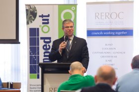
The latest in spatial data applications will be showcased at this year’s Mapped Out Conference to be held at the Rules Club in Wagga Wagga on Wednesday 2 & Thursday 3 March 2022.
Mapped Out will highlight the diversity of applications for spatial data, geographic information systems and their supporting technologies. Guest speakers with local and national experience will be showcasing the use of spatial data to enhance the operation and delivery of government services.
The Conference is a great opportunity for people working in regional NSW in both local government and the private sector to keep abreast of the latest technology and geographical information systems that can be utilised in their day to day work.

The National Surveying Congress will be an opportunity for leaders in the surveying profession to discuss the opportunities and challenges facing the profession. The 2022 Congress theme is ‘Automatic Mutual Relaxation’.
As the profession comes to understand the impact of Automatic Mutual Recognition for surveyors across the country, the event will provide an opportunity for surveyors from across Australia to gather and discuss the issues facing the profession and the opportunities for the future. The highlight of the program each year is the Cadastral Leaders Panel which sees all the Surveyors-General on stage speaking about changes and opportunities in their states and territories as well as an update from ICSM and ANZLIC. There will also be an online option.
The National Surveying Consultancy Excellence Awards and Gala Dinner will be held on the second day of the event, 23 June 2022.

The ITS Australia Summit 2022 in Brisbane will feature a strong industry program over three days driven by abstract submissions & invited keynote presentations, and will include technical tours & demonstrations, cutting edge industry exhibition, workshops, panel discussions, and an exciting social program.
As Australia’s leading transport technology event, Summit will demonstrate new insights and initiatives that will determine our path toward an accessible and automated future transport network.
GeoSmart India returns in 2023 for its 23rd iteration, with a theme of ‘Geospatial Infrastructure and Digital Twins: Powering National Economy’.
This year, the focus will be on strengthening India’s ambition of becoming a trillion-dollar economy. Geospatial infrastructure and digital twins will play a pivotal role in empowering the nation’s economy, enabling measurement of what can be seen in order to make better decisions across all major sectors.

Hosted by the Riverina Eastern Regional Organisation of Councils and the Riverina Spatial Information Group, Mapped Out 2023 will bring together public- and private-sector professionals to learn about the latest geospatial developments.
Mapped Out will highlight the diversity of applications for spatial data, geographic information systems and their supporting technologies. Guest speakers with local and national experience will be showcasing the use of spatial data to enhance the operation and delivery of government services.
The Conference is a great opportunity for people working in regional NSW in both local government and the private sector to keep abreast of the latest technology and geographical information systems that can be utilised in their day-to-day work.

The 2024 edition of the International Conference on Geographical Information Systems Theory, Applications and Management (GISTAM 2024) aims to create a meeting point of researchers and practitioners that address new challenges in geo-spatial data sensing, observation, representation, processing, visualization, sharing and managing, in all aspects concerning both ICT as well as management information systems and knowledge-based systems.
The conference welcomes original papers of either practical or theoretical nature, presenting research or applications, of specialised or interdisciplinary nature, addressing any aspect of geographic information systems and technologies, such as:
- Data acquisition and processing
- Remote sensing
- Interaction with spatial-temporal information
- Spatial data mining
- Managing spatial data
- Modelling, representation and visualisation
- GIS and climate change
- Domain applications

The Centre for Spatial Data Infrastructures and Land Administration (CSDILA) at the University of Melbourne, will host the Global Geospatial and Land Community at Melbourne Connect.
The program will include a Certified Leadership Training Course, which will equip executives and leaders with the knowledge, skills and insights needed to leverage geospatial technologies effectively, drive innovation within their organisations, and respond proactively to the evolving landscape of geospatial challenges and opportunities.
The associated Global Forum on Advancing Land and Geospatial Knowledge and Innovation will see the CSDILA and UN-GGIM bring together a leading team to deliver specialised leadership training in the domains of geospatial data and land administration.
Image credit: ©stock.adobe.com/au/Artofinnovation


