About this Event
Everybody talks about UAV LiDAR – the engineer in planning, the forester involved in wood mass calculation, the construction companies taking part in large projects to model it before, during and after its implementation or the utility companies for their corridor mapping and infrastructures management.
Reasons enough for us to continue the Yellowscan Demo tour in Australia, under the motto « Measuring the world with UAV LiDAR ». The scope is to show this high tech tool in a real working environment and how easy it is to generate topographic data with UAV LiDAR.
During our tour you will learn about the latest solutions and use cases from YellowScan and its partners with lectures, workshops and open discussions.
We look forward to meeting you !
YellowScan will be demonstrating two systems:
– YellowScan Surveyor Ultra, the high density & long-range LiDAR solution for UAV. Thanks to its high density (600 000 shots per second), this turn-key fully autonomous system is ideally suited for high speed & long-range projects. Its light weight (1.7 kg battery included) makes it also easy to mount on any drone.
Ideal Use cases: Mining, Archeology, Powerlines.
Applanix APX-15 & Velodyne VLP-32 inside.
– YellowScan Vx-20, the high precision & long-range LiDAR solution for UAV. This system is ideally suited for long range survey needs advanced accuracy (2,5 cm) and precision (1 cm).
Ideal Use Cases: Civil engineering, Forestry
Applanix APX-20 & Riegl miniVUX inside.
LiDAR systems are renowned for under vegetation 3D modeling, and fast data processing.
Contact :
Contact us for any question at laure.fournier@yellowscan-lidar.com

Presented by Bentley Institute, the Year in Infrastructure Conference is a global gathering of leading executives in the world of infrastructure design, construction, and operations focused on best practices and technologies for going digital.
The conference is globally recognized as the leading forum for addressing the current priorities and opportunities that impact the infrastructure industry. Attendees hear from industry thought leaders, engage in forums and discussions, and learn about technologies and best practices that will shape the future of infrastructure delivery and operations.
Keynotes
The Year in Infrastructure Conference mainstage is where industry leaders gain insight into how advancements in infrastructure, supported by Bentley technologies, are changing the world and accelerating possibilities. Mainstage presentations given by Greg Bentley and Keith Bentley share Bentley’s strategic vision and provide guidance for embracing going digital. Other presenters include Strategic Partner executives as well as respected global infrastructure leaders.
NEW for 2019! ACCELERATE
Join us at the brand-new ACCELERATE, and experience first-hand all the latest enhancements and key capabilities of CONNECT Edition. Meet Bentley’s product experts. Learn how to drive efficiency through multidiscipline workflows. Find out about infrastructure digital twins.

At 1Spatial we use validation, integration, automation and our rules-based approach to build strong data infrastructures, leading to better outcomes and making your data smarter.
Have you thought about how you will transform your data to GDA2020?
During this session, we will help you understand the requirements needed for GDA2020 and the best way to migrate your data to this new datum!
Join our team for a free webinar on Friday 27th November and hear how we can help you migrate your data to GDA2020.
Agenda
- Recognising your data and understanding the effect this will have on your data
- Authoritative data sets that already exist
- GA & ICSM slides defining the height datum + case studies of support issues
- Transformations with FME
- Ensuring your organisation has a plan for the transformation
- How we can help you implement the move
In the meantime, if you have any technical questions, or you’d just like a quotation on one of our products, some training or a dedicated consultancy session from one of our specialised consultants, just send us some details to sales.australia@1spatial.com and we’ll be sure to get back to you.
Did you know Australia is located on one of the Earth’s most rapidly moving tectonic plates? Resulting in Australia moving seven centimetres north-east per year!
Australian Government departments and private sector organisations are now contemplating their game plan for the migration of GDA94 to GDA2020. This data implementation is important for organisations that want to take advantage of having sub-decimetre coordinate accuracy when capturing high accuracy data.

Here at 1Spatial, we continue to work with customers across a range of diverse sectors delivering exciting and challenging projects that deliver new tools and platforms for managing their data. We have worked on projects with different customers to manage and track the transition to GDA2020- enabling users to migrate their data to the new datum.
During the session, we will hear from the latest case studies to help you understand the requirements needed to replace GDA94 with the new GDA2020.
Agenda:
- Opening intro – Andrej Mocicka
- Case Study – Whittlesea Council
- Case Study – Bayside Council
- Open Q & A with guest presenter Richard Stanaway from Quick Close
Join our webinar to learn how these organisations migrate their data to this new datum!
In the meantime, if you have any technical questions you would like answered during our session, send us an email sales.australia@1spatial.com and we’ll be sure to cover it.

RPAS in Australia Skies is back for 2023. The conference is the Australian Association for Uncrewed Systems’ (AAUS) main event for the year and has established itself as a landmark event for the Australian drone industry, drawing interest from key government personnel, representatives from the regulatory and safety bodies, defence force, RPAS and UTM representatives, end users and academia.
The hybrid event will take place over two days and will include a combination of presentations and interactive panel discussions.
The conference will cover:
- RPAS related policy and regulatory updates from Australian and international government agencies.
- UAS Traffic Management, low-level airspace and integrated airspace systems
- Industry challenges and perspectives
- Continuing development of a professional and safe industry.
- Emerging technologies and innovative solutions enabling RPAS integration in Australian airspace.
- Emerging applications — benefits, viability and social acceptance
- Case studies of drone use and challenges in emergency services, infrastructure inspection, delivery, mining, and agriculture.

The 2023 ACT Geospatial Conference and Excellence Awards will bring together colleagues old and new to hear the latest updates from across the local geospatial industry.
The call for abstracts for the event is now open. Any topic of interest to the geospatial industry is welcome, including surveying (cadastral, engineering, hydrographic, mining), GIS, remote sensing and geodesy, or broader topics such as new technology, diversity and workforce management.
The deadline for submission of abstract proposals closes at midday on Tuesday, 3 October.
The Geospatial Excellence Awards Reception will be held at the conclusion of the conference sessions, giving attendees the chance to enjoy drinks and canapes whilst networking and celebrating the award winners.
Image credit: ©stock.adobe.com/au/r-o-x-o-r

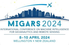
The International Association of the IEEE-Geoscience and Remote Sensing Society (GRSS), the IEEE-Computational Intelligence Society (CIS) and the local organising committee invite geospatial and computing professionals to attend the International Conference on Machine Intelligence for GeoAnalytics and Remote Sensing (MIGARS) to be held in Wellington, Aotearoa New Zealand in April 2024.
MIGARS aims to explore the interface of machine intelligence approaches with geosciences, spatial analytics, and remote sensing. With the tremendous developments in remote sensing technology, data acquisitions and sensing platforms, digital data have grown leaps and bounds to stream and are too big by volume, variety, and veracity. The challenge is handling, processing, and automating geo-data from various sources, such as multi-platform remote sensors and IoT devices, informing decision-making and monitoring our planet.
The conference will focus on connecting researchers from various disciplines, including computation/artificial intelligence, engineering, remote sensing, hydrology, agriculture and geosciences, and look for the potential use of intelligent computational approaches for geo-data-based applications and for serving society at large.

Southern Space 2024 will be a gathering of leading minds who will discuss how society can adapt to an ever-changing geopolitical, economic, environmental, social and strategic context, focusing on how the space domain can enable a more secure world.
The conference program will offer novel perspectives on current global challenges and opportunities, contextualising space within broader global trends.
Image credit: ©stock.adobe.com/au/immimagery


