

The International Federation of Surveyors (FIG) Working Week 2025 will be held at the Brisbane Convention & Exhibition Centre from Sunday, 6 to 10 April 2025.
The theme for the event will be: Collaboration, Innovation and Resilience: Championing a Digital Generation.
The Convenor for FIG Working Week 2025 is Steve Jacoby, Executive Director, Spatial Information at Department of Resources (Queensland) who has 23 years’ experience as a Senior Executive with the Queensland and Victorian Governments, leading their Spatial Information businesses. Steve has a keen interest in information management and seeing the use of spatial information reach its potential within government, business and the public.
The Program Chair is surveyor, Peter James who is the Business Development Manager, Cohga an Australian company with a focus on the development of IT products, and the provision of associated professional services. Peter is also the son of Earl James, Australia’s first and only FIG President.
FIG Working Week 2025 is a great opportunity for Australia’s geospatial community to showcase their technical expertise, strong research capability and warm hospitality.
For 2025, the annual Locate conference will be held in conjunction with the FIG Working Week 2025 conference, with both taking place alongside each other at the Brisbane Convention & Exhibition Centre, from 6 to 10 April.
Locate25 and FIG Working Week 2025 will offer unparalleled access to the international surveying and geospatial community, providing a platform to exchange experiences and stay at the forefront of developments across various aspects of surveying and geospatial practices, including ethics, standards, and education.
The overall theme for the 2025 event is ‘Collaboration, Innovation and Resilience: Championing a Digital Generation.’ It will feature an insightful and technical program with local and international practitioners, allied professionals and academics speaking on their field of expertise.

The Geo Connect Asia Show and Conference has scaled up from its launch in 2020 to become the regional meeting place for the fast expanding geospatial, positioning, digital construction and remote sensing markets.
With the growing application of geospatial based knowhow in decision-making across government, enterprise and non-profit the annual event comprises a show with a mix of thought leadership and technical platforms.
Last year’s event attracted more than 100 leading companies and 2494 visitors. Its co-location with Drones & Uncrewed Asia both presents the global UAV industries, but also addresses the importance of data acquisition and analytics in critical and emerging vertical markets.
Digital Construction Asia adds particular focus on the development of one of the region’s largest industries.
The addition of Marine & Hydro Asia expands the reach into the region’s hydro-marine data markets, which are so critical to the economy and security of Southeast Asia.
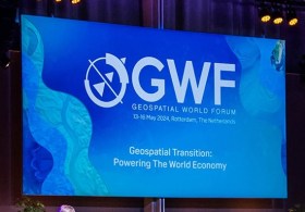
Geospatial World Forum (GWF) is a collaborative and interactive event that demonstrates the collective and shared vision of the global geospatial community.
This annual gathering brings together geospatial professionals and leaders representing national mapping agencies, private sector enterprises, multilateral and development organisations, scientific and academic institutions, and large end-users from government agencies and private businesses.
This, the 16th edition of the Forum, will be held in Madrid, Spain.
The third International Association of Geodesy (IAG) Commission 4 Symposium will bring together scientists, researchers and professionals working in the broad field of positioning and its applications.
The symposium will serve as a platform for discussing research that leverages current and emerging positioning techniques and technologies. It aims to provide both practical and theoretical solutions across a wide range of topics.
Discussions will address both technical and institutional aspects of developing GNSS backup systems, integrated positioning solutions, resilient PNT systems, and emerging LEO-based PNT techniques. The symposium will also explore space weather monitoring and forecasting through both ground-based and space-based geodetic observations. Additionally, the application of machine learning and artificial intelligence in geodesy will be examined.
The main topics to be covered include:
- Multi-frequency and multi-constellation GNSS technique
- Terrestrial and satellite-based positioning system development
- Multi-sensor fusion navigation and integrity monitoring
- Emerging positioning technologies, e.g., resilient PNT and LEO-based PNT
- Atmospheric space weather monitoring using geodetic observation techniques
- Applications of geodesy to engineering
- Artificial Intelligence technique for geodesy research
The Australian Space Summit & Exhibition is returning for its fourth consecutive year to throw a spotlight on the increasing strength of the nation’s space sector.
Coming at a critical time for the Australia’s space community, the summit will unite the sector’s most influential decision makers from across the public and private spheres over two days of presentations, discussions and displays.
The diverse agenda will feature more than 70 frontline presentations from leaders in the space and defence sectors, while presenting established and emerging industry players the opportunity for networking and discovery.
The Open Geospatial Consortium’s (OGC) 132nd Member Meeting will be held from June 9 to 12, 2025, at the Holiday Inn Mérida in Mérida, Yucatán, Mexico.
The event will feature several tracks on a variety of topics, especially innovation in geospatial interoperability.
The program will highlight how remote sensing technologies such as synthetic aperture radar, LiDAR and hyperspectral sensing are contributing to societal, economic, security, and disaster response scenarios.
The program will also explore how digital transformation is improving land administration and building information management.

Held every three years, the European Space Agency (ESA) Living Planet Symposium brings together diverse communities with a common interest in using Earth observation data, in a forum to meet and network with space professionals from a wide range of sectors.
Living Planet Symposium 2025 will have an emphasis on transitioning from ‘Observation to climate action and sustainability for Earth’.
The event will provide a forum to discuss the latest findings and applications based on satellite data, and to review the contribution that data and technologies have made and could further make in addressing environmental and societal challenges.
The symposium will also provide a chance for showcasing innovative products, services, missions and initiatives, with the overarching goal of demonstrating how science, society, policy-making, businesses and the economy can all benefit from observations made from space.
The 18th Australian Space Forum will bring together the best and brightest from Australia’s space industry and around the world. The event will feature keynote addresses from local and international space industry leaders and informative panel discussions on current space topics and industry trends.
Supported by the Australian Space Agency and the South Australian Space Industry Centre, the Forum will provide the ideal opportunity to stimulate ideas, share information about emerging technologies and network with influential space sector leaders and the broader community.
Participants can attend in person, or purchase session recordings if they are unable to physically attend.
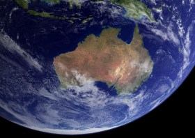
Image courtesy NASA/R. Simmon/R. Stöckli
The International Geoscience and Remote Sensing Symposium (IGARSS) is the flagship conference of the IEEE Geoscience and Remote Sensing Society. The 45th IGARSS will be held in Brisbane from 3 to 8 August 2025.
The theme of IGARSS 2025 is ‘One Earth,’ and the symposium will address threats to our Earth and promote collaborative global solutions that use remote sensing technology. The event will have strong technical and social programs, and present opportunities for regional and global collaboration.
Topics to be covered include:
- The contribution of international standards for land cover and land use and guidelines for SDG reporting
- Advanced satellite remote sensing techniques for coastal hazard monitoring and risk prediction
- Advanced signal processing methods for geoscience and remote sensing applications
- Applications of remote sensing in urban climate and sustainability
- Calibration and validation of space-based imaging spectrometers during a growth era of hyperspectral data sources
- Close-range sensing of the environment
- Deep learning and remote sensing for rapid disaster response
- Earth observation foundation models
- Hyperspectral geoscience mapping in developing countries
- New satellite laser data for terrain modelling
- Quantum technology for remote sensing
- Space LiDAR: Missions, technologies, and observations