
The Surveying and Spatial Sciences Institute invites you to engage with us at the Surveying & Spatial Sciences Institute NSW Conference 2018
The theme for this year’s conference:
“Earth – Air – Fire – Water”
The conference theme was chosen to reflect the diverse nature of spatial and surveying sciences which is inherently a multidisciplinary pursuit. Individuals within the spatial and surveying industry undertake many projects and tasks from the conference theme. From monitoring weather systems using small IoT devices to sending multi million dollar satellites into space, the surveying and spatial science fundamentals form the critical building blocks for success.
WHY NSW CONFERENCE?
Key opportunities at the conference:
- Meet a range of professionals and engage in presentations from industry leaders
- Explore the iconic coastline and fast growing city of Wollongong
- Network with people and make strong connections
- Celebrate NSWSEA with us at the Gala Dinner
Date: 14th-16th November 2018
Venue: Novotel Wollongong Northbeach
Registrations Now Open! To secure your place visit NSW Conference 2018 Registrations
CPD TOTAL: (Minimum points to be applied)
Spatial Stream including Keynote & Plenary sessions both days: 8.75 SP and 0.5 CAD
Surveying Stream including Keynote & Plenary sessions both days: 6 SP and 3.5 CAD
To view the Conference Programme click 2018 NSW SSSI Regional Conference Agenda (note Programme is subject to change by the Conference Organising Committee)
To nominate for the Awards click on the NSWSEA Awards Link
For a Nomination Kit click on 2018-APSEA-Nomination-Kit-FINAL.pdf
For accomodation details click here
Like to stay longer? Visit Wollongong
Interested in the Pre-Conference workshop on Fire Mapping? click here

Although it has been almost 50 years since there have been a requirement for field information to be lodged, Sec 71 (e) of the Cadastral Rules for Survey 2021 requires the submission of “all relevant field information, in a form that ensures permanent usability”.
While surveyors have been retaining field information electronically, LINZ has found that in many cases the data has been inadequate or needs specific software, or there can be difficulty identifying raw measurements after processing or to relate them to the dataset.
This seminar will share insights from knowledgeable suppliers and practitioners to assist surveyors develop systems and processes to comply with the Rules and to present electronic field data in a clearly readable way.
Participants can attend in person or online.

The Survey and Spatial New Zealand 2021 Annual Conference will draw on the ability of individuals and teams to adapt to change, adversity and setbacks in the current environment.
The conference program will include presentations on rebuilding and improving the economy, with a focus on resilient mindsets to support our members while they navigate the challenges and changes ahead. By sharing concepts, ideas and knowledge, industry members have opportunities to help build back the survey and spatial sector.
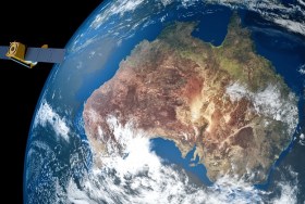
The Space & Geospatial Collaborative Workshop will be jointly hosted by the Andy Thomas Space Foundation and the Surveying and Spatial Sciences Institute in Adelaide the day following the 12th Australian Space Forum and the day before Spatial Information Day.
This inter-disciplinary workshop will provide a unique opportunity for professionals from both space and spatial sectors to:
- Learn about Australia’s renewed commitment to space technology development
- Get updates on the requirements and capabilities of the modern spatial information industry using applications such as PNT (positioning, navigation and timing), EO (Earth Observation) and telecommunications
- Connect and discuss the increasing synergy and collaborative opportunities between the two sectors.

Organised by OSGeo, this international annual gathering of location enthusiasts is the largest global gathering for geospatial software. Now in its 15th year, FOSS4G (ie. Free and Open Source Software for Geospatial) brings together developers, users, decision-makers and observers from a broad spectrum of organisations and fields of operation.
Through six days of workshops, presentations, discussions, and cooperation, FOSS4G participants create effective and relevant geospatial products, standards, and protocols. The 2021 event will be focused for the first time on South America and will be held with the close collaboration of the GeoLibres Association in Buenos Aires, Argentina.

The Australasian Hydrographic Society’s HydroSpatial2021 Conference will focus on how hydrography will develop in the future, noting the development of ‘digital twinning’ and the emerging name variants for hydrography such as ‘hydrospatial’ or ‘hydrogeomatics’.
The conference theme, Hydrography of the Future, morphs two modern yet wide-ranging aspects of the hydrographic surveying profession, and should draw papers from relevant scientific, technological, operational and environmental communities. The aim is to provide delegates with valuable insights, creative ideas and inspiration on how to harness current and future technologies, systems and processes so that they can deal with present challenges and prepare for a more sustainable future.
Registrations are now open for the Australian Institute of Mine Surveyors (AIMS) Kalgoorlie Regional Seminar, which will be held at the Kalgoorlie Bowling Club on Friday, 29 October.
The day will start at 2:30pm with an optional lawn bowls and beers social occasion, followed at 4:00pm by AIMS sessions and a sponsor interaction session. Drinks and nibbles will be supplied. Sponsors include AAM, Arvista, Caroni, Deswik, GeoCue Australia, HL Geospatial and Maptek.
There are various levels of registration fees depending upon member category. Full details can be found at the link above.

The Institution of Surveyors NSW (ISNSW) Annual Conference (formerly Australia Day Seminar) is the premier ISNSW event. Held annually, this two-day conference attracts over 400 surveyors from metropolitan and regional areas of New South Wales.
The conference content will address pressing issues common to surveyors working in New South Wales, and offers a quality, value for money education and networking experience covering a range of topics.
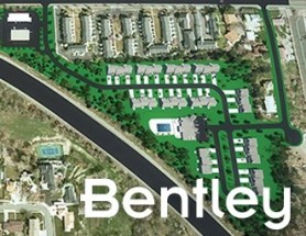
Join Bentley Systems at the launch of what it says is the industry’s most complete Survey and Site Design Solution ever offered to the ANZ market.
As technology advances and industry expectations increase, your software needs to keep pace with this ever-changing environment. In short, your software needs to deliver on today’s requirements and be ready for tomorrow’s challengers.
If you work in road design, site surveying, site development and related fields, this webinar is for you.
Throughout the launch, Bentley Systems will demonstrate traditional survey data capture capabilities, coupled with the latest mass data collection survey methods, including Total Station techniques, Point Cloud techniques and Digital Photogrammetry techniques.
Leveraging the above survey results, the launch will continue through a typical site design workflow, incorporating aspects such as:
- Terrain creation and analysis
- Urban road widening design
- Carpark and recreational area design
- Drainage and Utility design and analysis
- Plan production and digital model delivery
- Model visualisation
Air Inspect Australia will also be joining the webinar to share their insights and learnings of their project.
If you or your company perform any of the above-mentioned workflows, then this is one webinar you should not miss.

The theme for the Association of Public Authority Surveyors, NSW’s (APAS) 2022 annual conference will be ‘Surveying on the edge’. APAS was formed in 1994 to cater for needs of professionals in the surveying and spatial information industries working within state and local government and the education sector.
As a cooperating association of the Institution of Surveyors NSW and through its involvement with the Board of Surveyors and Spatial Information, APAS has a significant voice in the wider surveying and spatial information community.


