The Rail Baltica Global Project is an ongoing greenfield railway infrastructure project to link Finland, Estonia, Latvia, Lithuania and Poland with a European standard gauge rail line. When it comes to modelling this highly ambitious project in a digital environment, in order to manage Rail Baltica as a single asset, RB Rail AS has been developing a detailed BIM strategy that will be used during the design, construction and operation of the line.
With the design phase well underway and with works ongoing on 411 km of the main line, the BIM strategy has already been applied, and the designer has already submitted the first value engineering solutions using RB Rail AS proprietary BIM standards.
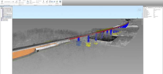
Value engineering stage. A federated BIM model, including a point cloud of the existing situation, a railway track embankment and alignment, and a bridge structure.
The detailed BIM strategy was developed by AECOM INOCSA SL – it consists of extensive documentation and templates that will be used for the successful implementation of the BIM process for the Rail Baltica Global Project.
The strategy defines the rules and principles that all parties involved in the project must follow. These rules ensure that all information delivered during the design and construction stages of the project is created and organized using the same principles, to ensure interoperability between deliverable from the different disciplines, and even between deliverables from different design companies.
Open data approach
One of the main focuses of this strategy is to ensure smooth information transfer for future asset management, so that all the valuable data collected about the assets during the design and construction stages remains usable throughout the entire lifecycle of the infrastructure. In other words, information about the real, physical, built assets is collected, stored and maintained in a database and can be used for maintenance of the railway infrastructure throughout its full operating period.
For example, if a catenary post is designed in a digital environment – using the BIM system – then the database contains information about its geometry, location, materials, fixtures, and specifications. During the construction stage, information about the built asset is added, e.g. the installation date, maintenance manuals and the construction schedule. Then later, during the maintenance and operation stage, all of this information can be used for creating maintenance schedules, creating work orders, etc.
Proof that the detailed BIM strategy has been successfully developed can be found in the release of the first value engineering deliverables for the design sections in Lithuania and Estonia.
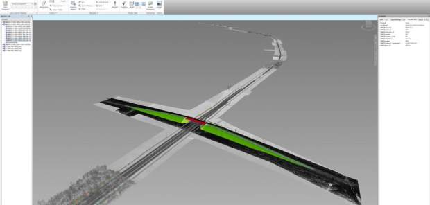
Value engineering stage. A federated BIM model, including a point cloud of the existing situation, a railway track embankment and alignments, and an overpass structure.
A common data environment
Another very important aspect of the strategy is defining the file structure, formats and content of the delivered data. Nowadays, there are many different types of design software, each of which usually has its own proprietary file formats. These file formats serve their purpose if all the design work is done using one software solution for all disciplines. But as soon as this information needs to be used in another software solution, the interoperability between different formats becomes very important.
The strategy uses an open BIM approach, where the main exchange format used is IFC, which makes it possible to review graphical and attribute information in many different software solutions. The end user can pick their software and will still be able to access the information.
Files in a native format are required so that all the information is collected and archived. This is a very important aspect for being able to edit the information if necessary, e.g. when using the initial information for possible future designs.
Based on the developed strategy, a CDE (Common Data Environment) was procured and its deployment has already started. Bentley Systems Inc.’s ProjectWise CONNECT Edition solution was chosen as the best-suited for the railway infrastructure project, as it ticks all of the boxes – it is a modern, industry-leading solution that ensures collaborative workflows between all parties involved in the project. For the next couple of months, extensive work will be underway to deploy and configure the system, so that it is tailored to the specifics of the Rail Baltica Global Project.
Parallel to these developments, a GIS solution using the ESRI ArcGIS system is also being implemented for the project. The use of GIS, in combination with other digital data, opens up several different use cases, from land acquisition planning to representing geotechnical investigation results. Orthophoto and LiDAR (point cloud) data are collected using UAVs and aeroplanes. It allows to examine both natural and manmade environments with accuracy, precision, and flexibility. Engineers are using LiDAR to produce more accurate maps, make digital elevation models for use in GIS, as basis for design, etc. The use cases for utilizing the collected data is almost endless, and as the Global Project evolves, the technologies involved will evolve as well, as will use cases for all the technological solutions.
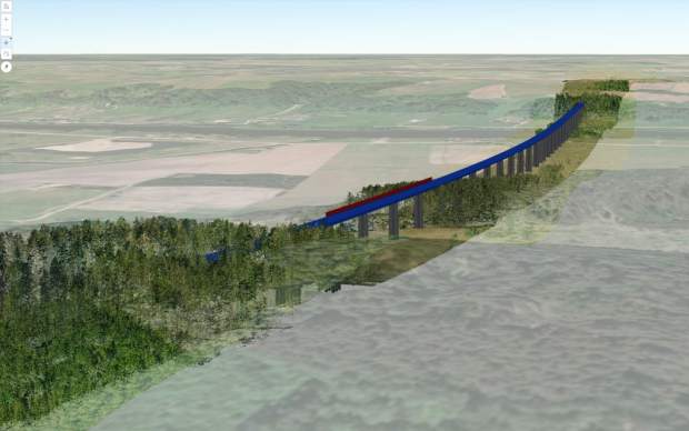
Value engineering stage. 3D view in GIS web interface.
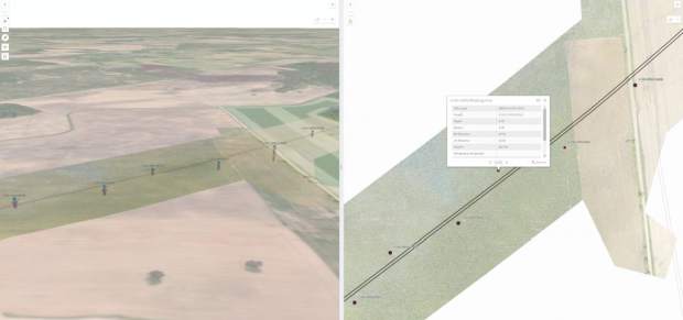
Site investigations stage. 3D/2D view in the GIS web interface for geotechnical site investigation.
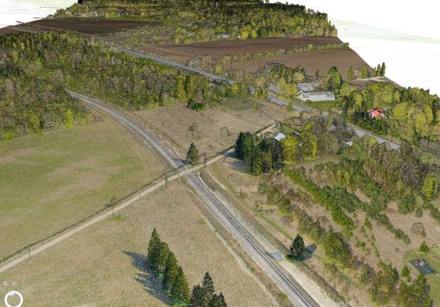
Existing situation terrain model – Orthophoto + LiDAR (point cloud).
This article was contributed by Rail Baltica.


