The 3D scanning Project Tango tablet.
PC & Tech Authority has it on good …authority… that LG will be releasing a consumer version of Google’s Project Tango 3D-mapping tablet next year. Welcome to the future.
In other consumer-meets-spatial-interests news, Mashable has the news that the FAA has clarified to Amazon that using drones to deliver books is illegal.
IN other drone/UAV news, North Carolina is set to ban UAVs being used for fishing and hunting – which is a use I wasn’t aware of, and conjures up images of gun and missile totin’ quadcopters, although I’m fairly sure that they were only being used with cameras.
Google Maps Mania highlights a great interactive visualisation by the New York Times that explores the rise of ISIS by following the paths of the Tigris and Euphrates Rivers using satellite/aerial imagery.
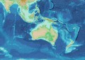
The writer behind Google Maps Mania, Keir Clarke, has also created a map of the USA as it may look if Australia was to invade.
Oh, and why not just one more from this ever-interesting resource? You will also find a ‘navigating the Roman Empire’ post, which highlights some of the best interactive maps that represent the Roman Era.
Google’s Geo Developers Blog has posted a video recap of Google Maps updates at the recent Google I/O event.
IEEE Spectrum carries the news that NASA has launched a carbon-tracking satellite – the Orbiting Carbon Observatory (OCO) satellite, which promises global tracking of carbon dioxide entering and leaving the atmosphere at ground level – after two previously unsuccessful launches.