

Protecting and preserving Australia’s ancient landscape using cutting-edge drone and mapping technology.
First published 21 October 2024
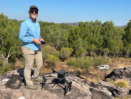
Renee Bartolo is the Director and Chief Remote Pilot for the Office of the Chief Remote Pilot, in the federal government’s Department of Climate Change, Energy, the Environment and Water. A life-long environmental enthusiast, she has parlayed her passion for nature into a career in remote sensing, specialising in drone operations.
In this interview, we ask her about her background, her work, and why she likes her job so much.
Where did your passion for the environment come from?
Ever since I can remember, I have loved the environment and knew from a very young age I was going to work in a role that contributed to understanding and protecting it. I grew up adjacent to a bush reserve in Sydney and spent a lot of my time exploring or just hanging out there. It is what drew me to move to the Northern Territory.
I have always felt grounded and most happy in the bush. Being in the field opens creative thinking for myself and our team when we are out and about.
How did you get into the drone field?
I have worked in northern Australia for over 25 years looking at ways of using remote sensing to understand landscape dynamics, including ecosystem restoration. My background is in Earth observation (remote sensing) and landscape ecology. My PhD was on the use of multi-frequency, multi-polarised synthetic aperture radar for estimating Melaleuca biomass in tropical wetlands.
Given the nature of using more traditional forms of remote sensing (satellite and crewed aircraft) and the increasing resolution required to understand ecosystem processes, we kept a watch on drones from around 2010. Drones are not as affected by cloud cover and fire, which are prevalent for most of the year in the tropics.
In 2013 we saw that the use of drones was viable and in 2014 we commenced drone operations, and I became the Environment Department’s Chief Remote Pilot. Everything has grown from there.
What does your role involve?
I lead a team that delivers a number if functions: ensuring safe and compliant use of drones; building capability of drone operators and facilitating demonstration projects to deliver operational solutions; facilitating cross-cutting science and innovation and taking research to application; and coordination of resources, including people, the drone fleet and projects to avoid duplication of effort and resources.
The Department uses drones to provide:
- Innovative and expert advice grounded in evidence and science.
- Regulatory compliance and surveillance activities.
- Land management, visitor safety and infrastructure inspection in Commonwealth Parks.
- Engage and partner with First Nations ranger groups.
- Staff safety and wellbeing in operational settings.
What sort of projects does your team tackle?
We engage in complex projects or capability uplift that is cross-cutting and can result in transformational change or insights. Our focus is #dronesforgood. Some examples are:
- The Ghost Nets Initiative. This is an Indigenous-led design of the use of drones and AI by Indigenous ranger groups in northern Australia to monitor ghost nets and marine debris.
- Population surveys of threatened animal species using drone-based thermal sensors.
- Detection of saltwater crocodiles through the development of an integrated sensor network and real-time alerts.
- The use of drones and AI in detecting, monitoring and the control of buffel grass.
Does your work cover all of Australia?
The drone operations for our Department span from Antarctica to Christmas Island National Park and everywhere in between, across a diverse range of applications.
We also work with the Department of Agriculture, Fisheries and Forestry and some of our portfolio agencies (Great Barrier Reef Marine Park Authority and the Bureau of Meteorology). We provide the support and organisational and operational framework for other agencies to use drones for environmental work.
What are some of the challenges you encounter?
We come across challenges daily, whether it be from the drone operations themselves, ITC requirements and the volumes of data we are dealing with and what we are wanting to do with that data, and organisational risk management. We overcome these challenges by having a team with diverse backgrounds and experiences, and by being people centric. Being people-centric means we have instilled a just culture for the drone operators and are there to support our people in their use of technology.
Does the Department do all of its own drone work, or does it also outsource?
We are focused on building capability within work areas, but the Department also outsources drone operations or research through grant programs or specific projects.
What sort of technologies do you use?
We have a range of technology and capability that we test and use across the drone operations. We have a variety of sensors including high-resolution cameras, multispectral sensors, thermal, LiDAR and radar doppler. Similarly, there is a range of multi-rotor and VTOL platforms with different endurances. We also have weed spraying and delivery drones, as well as new payloads being developed and applications such as eDNA collection from rivers.
For our integrated sensor network development, we are using a combination of sonar and IoT IR and high-resolution video sensors. In relation to the data side of the drone operations, we have used edge devices in situ and also streamed into our cloud. In terms of operational capability, we can conduct Beyond Visual Line of Sight operations and Extended Visual Line of Sight and Night operations.
Are there any new developments that will make your work easier?
We tend to focus on the leading edge and pushing into new technology and operational use. Some of the use cases we are currently working on are:
- The use of autonomous drones (Drone-in-a-Box) and Remote Operations Command, which will enable us to use drones in some of the more remote locations without having to be physically present. This will change how some of our environmental monitoring and compliance work is undertaken, providing increased capability in obtaining hyper-temporal data.
- Beyond Visual Line of Sight aerial incendiary operations for prescribed burning.
- The recent Aviation White Paper provides potential pathways for safer operations around crewed aircraft.
What are some things about your work that people probably don’t know?
We are trying to solve complex issues in the application of AI to large drone datasets of ecosystems, which poses a range of challenges in scaling and ensuring AI models can operate across a range of conditions… especially if there are multiple types of objects being detected.
Having a geospatial background has been particularly useful in assessing and preparing safety cases for Beyond Visual Line of Sight applications using the Specific Operations Risk Assessment (SORA) framework.
We also have a focus on inclusion in the drone industry, given the diversity across our drone pilot cohort, and how a traditional aviation framework can be made accessible to everyone wanting to use drones.
What do you enjoy most about your job?
The people we get to work with and building their capability in the use of drones and AI is the most enjoyable part of the job. We use cool technology to address complex questions or problems, but we see our role as being about people. People come to us with ‘Can we…?’ ideas and we work together to innovate, test their ideas and then build the capability. Inclusion is at the centre of everything we do.
The other aspect of the job I enjoy is the ability to work on complex and cross-cutting issues and use cases. We seek to focus on use cases that can affect transformational change, whether it be for informing policy, providing scientific evidence to make decisions, undertaking functions in a more time- and cost-effective manner, or keeping people safer in the jobs that they undertake.


