

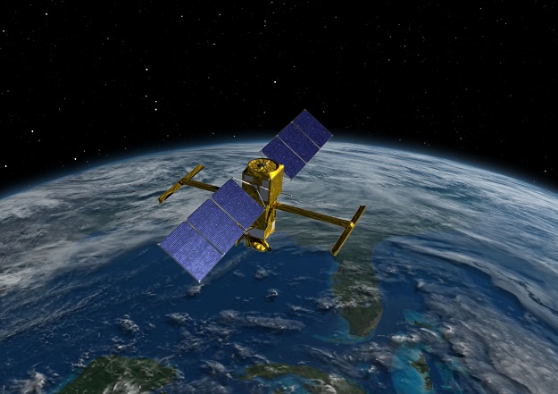
An artist’s impression of the SWOT satellite in orbit. Courtesy NASA.
The Surface Water Ocean Topography (SWOT) satellite is set to change the way scientists observe our oceans and inland waters. Launched on 16 December from the Vandenberg Space Force Base in California and jointly developed by NASA and French space agency CNES, along with the Canadian Space Agency and the UK Space Agency, this new mission is being described as a game-changer.
For the past 30 years, satellite radar altimeters have been used with some success to measure ocean topography, boosting our understanding of the ocean, its role in the global climate system, and providing the capability to forecast the ocean in a similar way to weather forecasting.
The SWOT satellite boasts a new radar interferometric system that will essentially increase the resolution of ocean topography maps from approximately 25 km to 2 km over the next 12 months.
Not only will SWOT improve the ocean topography in the open ocean, it will drastically improve the quality of measurements closer to the coast and even over inland waters.
Australia is making a significant contribution to the international SWOT mission through the Integrated Marine Observing System (IMOS) Satellite Altimetry Calibration and Validation Facility in Bass Strait.
IMOS, working with partners the University of Tasmania and CSIRO, have upgraded the site with new GNSS-equipped buoys and sub-surface instruments to help validate the SWOT mission.
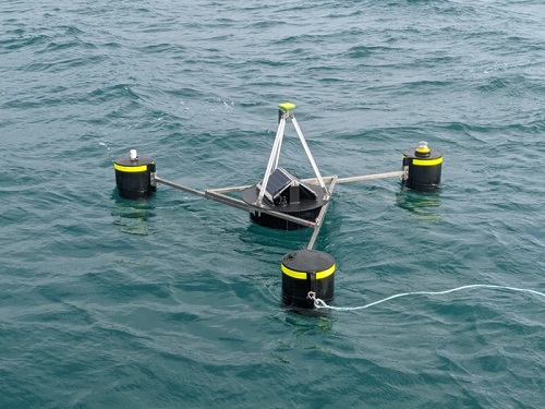
Satellite altimeter Cal/Val GNSS/INS-equipped buoy for precise sea surface height determination. Credit: Jack Beardsley, UTAS/CSIRO.
The GNSS buoys will measure the sea surface height very accurately in a way that is directly comparable with the SWOT satellite. To further assist, IMOS has supported instruments deployed in the ocean below the surface that will help tell scientists about ocean properties that contribute to its height, such as temperature, salinity, pressure and current.
During the validation phase of the SWOT mission, the new satellite will be in a special orbit where it will fly over Bass Strait once per day for around three months. Bass Strait is the only site globally to be involved with SWOT that has contributed to altimetry validation since precision missions commenced in late 1992.
One of the reasons for selecting the satellite track was the location of the IMOS Bass Strait facility, and the IMOS team’s recognised world-class expertise in assisting with satellite measurements and their validation.
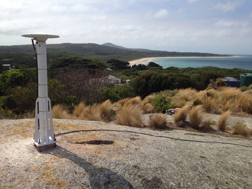
Looking east towards the Bass Strait altimeter validation site from the GNSS reference station on Three Hummock Island. Data from this site will be used to improved positioning of buoys and other sensors in Bass Strait, providing an Australian contribution to SWOT calibration and validation. Credit: Christopher Watson, UTAS.
“We’re surrounded by ocean that regulates our existence in so many ways — our inland waters are critical to our environment and how we interact with it. This is one opportunity to provide an Australian contribution back to a satellite mission that will provide a step change in understanding water and its role in our lives,” says Dr Christopher Watson, leader of the IMOS Satellite Altimetry Calibration and Validation Facility, and Senior Lecturer at the University of Tasmania.
IMOS has been operating a wide range of observing equipment throughout Australia’s coastal and open oceans since 2006. It is enabled by the National Collaborative Research Infrastructure Strategy and is operated by a consortium of institutions as an unincorporated joint venture, with the University of Tasmania as Lead Agent.
IMOS makes its data openly and freely accessible to the marine and climate science community, other stakeholders and users and international collaborators.


