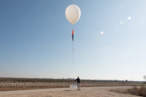
A company that uses balloon-borne sensors to conduct aerial imagery from altitudes three times higher than those used by commercial airliners, has just closed a US$20 million Series B funding round.
Near Space Labs says it will use the funding to “accelerate delivery of its ultra-high-resolution, frequent aerial imagery across the continental United States,” increasing coverage to include 80% of the US population twice per year.
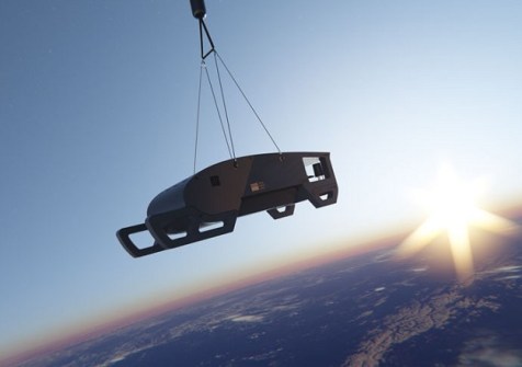
The company has been building market share in sectors such as property and casualty insurance, by providing 7cm imagery using its fleet of balloon-borne Swift ‘robots’.
The new funding will enable the company to expand its Swift fleet, which, it says, will make it capable of “capturing imagery of areas equivalent to entire cities like New York or Los Angeles within just a few hours”.
According to the company, to do the same with drones would require approximately 800,000 flights and days or weeks of effort.
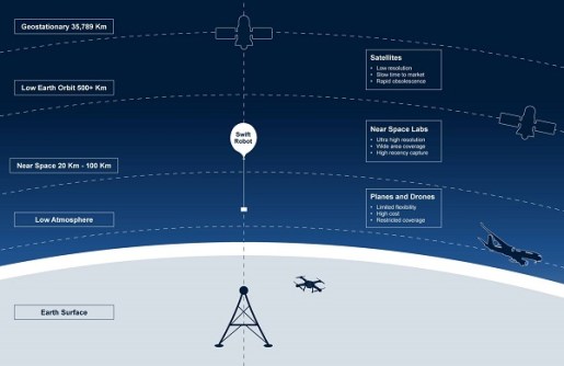
The Swift robots operate at altitudes high above those used by commercial aircraft, but far lower than satellite orbits.
Near Space Labs says its system can be rapidly mobilised for urgent missions.
“Earth observation users have been forced to choose between satellite imagery lacking detail and traditional aerial surveys that are costly and infrequent,” said Rema Matevosyan, CEO and co-founder of Near Space Labs.
“Our unique stratospheric approach eliminates this dilemma, combining satellite-like coverage with market-leading resolution.
“With our nationwide technical infrastructure now in place, this funding enables us to scale our operations and execute on our product roadmap.”
The Series B funding round was led by Bold Capital Partners, founded by entrepreneur Peter Diamandis of XPRIZE and Singularity University, with participation from USAA, Climate Capital, Gaingels and River Park Ventures, along with existing investors Crosslink Capital, Third Sphere, Draper Associates and others.
“Near Space Labs has solved a fundamental challenge in geospatial intelligence: delivering high-resolution imagery with the frequency, scale, and economics that truly unlock commercial value,” said Will Borthwick, Principal at Bold Capital.
“Their industry-first, nationwide stratospheric robotics platform is uniquely positioned to do for aerial imagery what SpaceX did for satellite launches — dramatically increasing access while reducing costs.”