ArcGIS users may soon access a suite of powerful data extraction tools.
About Daniel Bishton
-
30cm imagery reveals extensive military infrastructure on artificial islands in the South China...
2018-03-06
Java developers rejoice: extensive GIS-focused SDK released by Polish software house TatukGIS.2018-03-05
Victoria’s Surveyor-General offers an exclusive insight into his designs for the role.2018-02-28
ADVERTISEMENTThirty deaths and 300 injuries reported after powerful quake.2018-02-26
SA government will match IoT startup’s $1.36m investment to create 50 high-tech jobs.2018-02-26
Spatial app visualises Australian property values 2012-2017.2018-02-26
First two microsatellite nodes of Starlink network reach low earth orbit.2018-02-26
Aussie pilots are now required to answer nine questions on flight safety before...2018-02-21
Spatial Source’s roundup of the best in cartography and spatial data visualisation from...2018-02-21
Decision support tool provides open access to global water quality data at a...2018-02-20
Newest version of offline map-making software offers considerably greater detail and cloud-syncing.2018-02-19
Hear from leading thinkers and climate change communicators at Xtreme Weather 2018.2018-02-14
A new player has entered the Australian GNSS and RTK market.2018-02-14
Think you can out-count a drone? Think again.2018-02-13
Aeolus will provide near-realtime data on global wind patterns.2018-02-13
Trimble targets new users with its latest mobile mapping unit.2018-02-13
Seabed Constructor disappears from AIS, agitating followers of search and relatives of those...2018-02-08
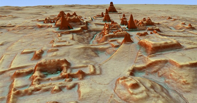
Use of LiDAR instrumental in uncovering of ancient cities beneath the Guatemalan jungle.2018-02-07
Newsletter
Sign up now to stay up to date about all the news from Spatial Source. You will get a newsletter every week with the latest news.
© 2026 Spatial Source. All Rights Reserved.
Powered by WordPress. Designed by


