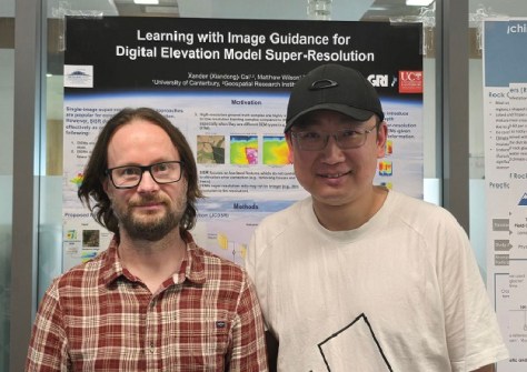
Researchers from Te Whare Wānanga o Waitaha | University of Canterbury’s (UC) Toi Hangarau | Geospatial Research Institute, have developed a model that uses AI to enhance flood-risk modelling.
The deep-learning model is called Joint Spatial Propagation Super-Resolution (JSPSR).
Professor Matthew Wilson says the team’s goal is to democratise access to accurate elevation data, which is essential for purposes such as flood-risk modelling and infrastructure design, agriculture and renewable-energy development.
“AI allows us to achieve high accuracy and good spatial resolution using open satellite data that is accessible to everyone,” he said.
Although aerial LiDAR capture is the most accurate option, for many nations it is too expensive and logistically demanding, requiring specialised aircraft, equipment and technical capability.
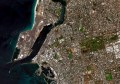
Addressing this gap, JSPSR uses AI to generate high-resolution, bare-Earth digital elevation models (DEMs) using only open satellite data and modest computing power.
Early results show that the JSPSR model can deliver a ten-fold improvement in spatial resolution, and around a 72% improvement in elevation accuracy, compared to the basic datasets.
In addition, JSPSR delivers 1.05-metre RMSE vertical accuracy from 30-metre input data, and up to four times faster processing than the widely used Enhanced Deep Residual Networks for Single Image Super-Resolution (EDSR) method.
“While the new technology is not a replacement for LiDAR, JSPSR provides far more accurate elevation information than current free satellite datasets at a fraction of the cost of LiDAR,” said researcher Xiandong Cai.
“This could transform flood-risk mapping and environmental planning for districts or countries that currently lack the resources to capture LiDAR data.
“Our ongoing work aims to further refine and validate the model so it can be applied reliably across global landscapes.”
Potential applications include:
- Flood-risk assessment, stormwater design and transport planning;
- Irrigation modelling, erosion monitoring and precision agriculture;
- Sea-level rise modelling, habitat mapping and carbon-stock estimation; and
- Hydrological modelling, hydro site design and renewable generation planning.
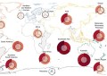
The research matches the goals of the AI for Good movement, led by the International Telecommunication Union, which encourages the use of AI to advance the UN Sustainable Development Goals.
“By making high-quality terrain data affordable and accessible, the UC team’s work supports global efforts to strengthen climate resilience, reduce inequalities and enable sustainable infrastructure development in regions that need it most,” said Professor Wilson.