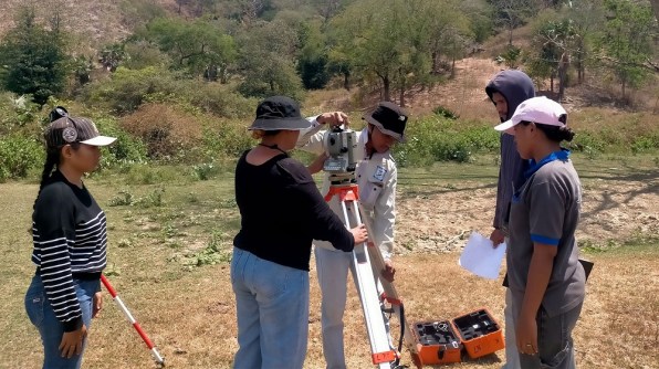
The training enabled Timor-Leste staff and students to survey water catchment topography for use in catchment modelling.
Staff and students from Timor-Leste’s Universidade Nacional Timor Lorosa’e (UNTL) have taken part in hands-on surveying training and fieldwork as part of a project with UNSW Engineering and Permatil.
The training is supporting UNTL’s contribution to an Australian Centre for International Agricultural Research (ACIAR) project focused on sustainably managing available water resources for improved food and water security in the country.
Rather than UNSW researchers collecting the required data themselves, the project is designed to equip UNTL staff and students with the skills and equipment to carry out surveying in their own country.
The approach reflects the La’o Hamutuk principle — meaning ‘walking together’ — that underpins UNSW Engineering’s engagement with Timor-Leste.
“The focus of the training was to enable local staff and students to effectively survey water catchment topography and specific features for use in catchment modelling by UNSW’s Water Research Centre,” said Peter Mumford, a technical officer from the School of Civil Engineering.
“Ultimately the aim is to assess and improve water access for rural communities in Timor-Leste.”
The training involved three UNTL staff members, Jovita Costa, Apolinário Eusebio Alves and Moises Martins Mendonça, and seven students: Milcarenoço Soares, Cedelisio da Silva, Enoque da Silva Fátima dos Reis, Mariantino Faelo Anunciação Preto, Filomena Costa Xavier, Dulce da Conceição and Franculino dos Santos Steves.
Understanding water catchments
The team is collecting detailed information about the shape and features of water catchments, including the location and size of nature-based solutions such as retention ponds.
Nature-based solutions use natural or modified features of the environment to help address challenges such as water management. In Timor-Leste, understanding how these features are distributed across a catchment can help researchers better understand how water moves through the landscape.
The survey data will be used to develop conceptual models of catchment water behaviour. These models can then contribute to numerical modelling by UNSW’s Water Research Centre, helping researchers assess potential ways to improve water access for rural communities.
For UNTL, the work also provides an opportunity to develop surveying expertise that can be applied to future research, infrastructure planning and environmental projects.
“As part of UNSW Engineering’s Country Engagement Strategy for Timor-Leste, a core focus of the partnership with UNTL has been building the local technical capability needed to sustain research outcomes long after a project ends,” said Professor Rita Henderson, Deputy Dean (Societal Impact & Translation).
“That commitment recently took the form of hands-on survey training and fieldwork, delivered to support UNTL in fulfilling its component of the ACIAR Small Research Activity (SRA).”
Learning by doing
The training began with an introduction to surveying theory before participants moved into practical exercises using Total Stations, tripods and prisms.
The group first completed a small exercise to practise taking and recording measurements before moving to a larger survey area in a rural location outside the UNTL campus.
There, participants had to plan the survey network themselves in the field before collecting measurements — an important step towards being able to undertake future surveys independently.
The training then moved to data preparation and processing, including the use of Fixit4, a least-squares adjustment software package.
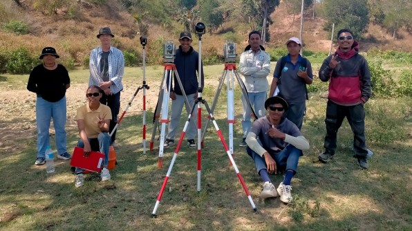
UNSW also provided equipment to support the training and future fieldwork, including two Nikon Total Stations, tripods, prisms and poles, a tablet computer, a GNSS receiver, survey-processing software and four handheld radios for communication during fieldwork.
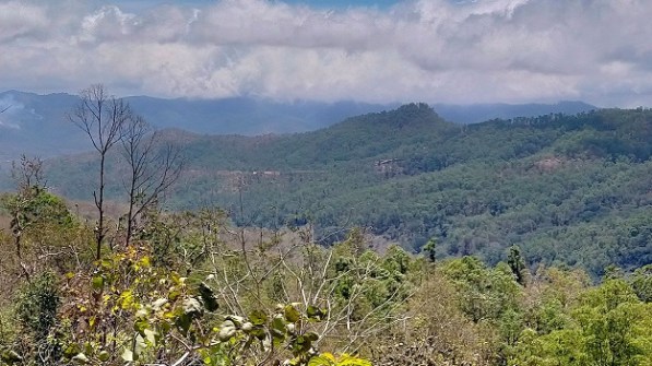
The most challenging part of the week came when the team travelled into the mountains to survey a catchment around Fatuquero, a village south of Dili at an elevation of approximately 900 metres.
The larger survey required the team to work together to capture the upper part of the catchment and document numerous retention ponds, known locally as debu.
Despite the greater size and complexity of the survey, the team successfully completed the fieldwork.
The following day was spent back at UNTL preparing and processing the data. While analysis is continuing, early indications suggest the data collected during the fieldwork is of good quality.
Building capability for the future
The surveying work is part of UNSW Engineering’s broader Country Engagement Strategy for Timor-Leste, with the country serving as a pilot for developing new approaches to international partnerships.
The strategy focuses not only on delivering individual research projects, but also on how universities can work together to build lasting technical and organisational capability within partner countries.
This means working alongside local institutions such as UNTL, rather than simply delivering projects on their behalf.
“This has been a fantastic collaboration,” said Jovita Costa, a researcher from UNTL.
“The training and equipment support have greatly upgraded our capacity and improved our surveying skills and mapping, which will ensure better results for our task and future work.”
The same approach is intended to support UNSW Engineering’s broader partnerships in Timor-Leste, including work with local universities, government, and communities, particularly including local non-profit organisation Permatil.
For the current project, the immediate focus is on processing the Fatuquero catchment data and incorporating it into the wider research and catchment modelling work.
But the longer-term outcome is the capability that remains with the people who took part.
By learning how to plan, conduct and process catchment surveys themselves, UNTL staff and students can continue applying these skills to future research and practical challenges in Timor-Leste.